
Fort McMurray Fire
May 2016 - An unusually hot and dry airm mass over Northern Alberta set the stage for a large wildefire to blaze out of control near the town of Fort McMurray. As of May 6, the fire had destroyed over 1600 buildings in the town, which had been completed evacuated. The VIIRS instrument on Suomi NPP was able to capture the progression of the fire and its aftermath as shown in the images below.
M13 Band Imagery from May 4 (left) and May 6 (right)
William Straka (CIMSS)


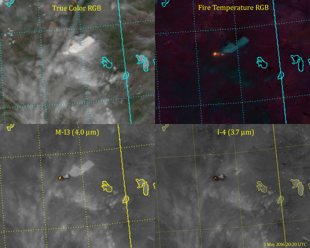
Four panel fire imagery from various VIIRS bands from May 3-7
Curtis Seaman
Animation showing the progress of the fire, as captured by various VIIRS bands (or combinations), from May 3-7.
DNB Imagery from May 4 to May 10
William Straka (SSEC/CIMSS)
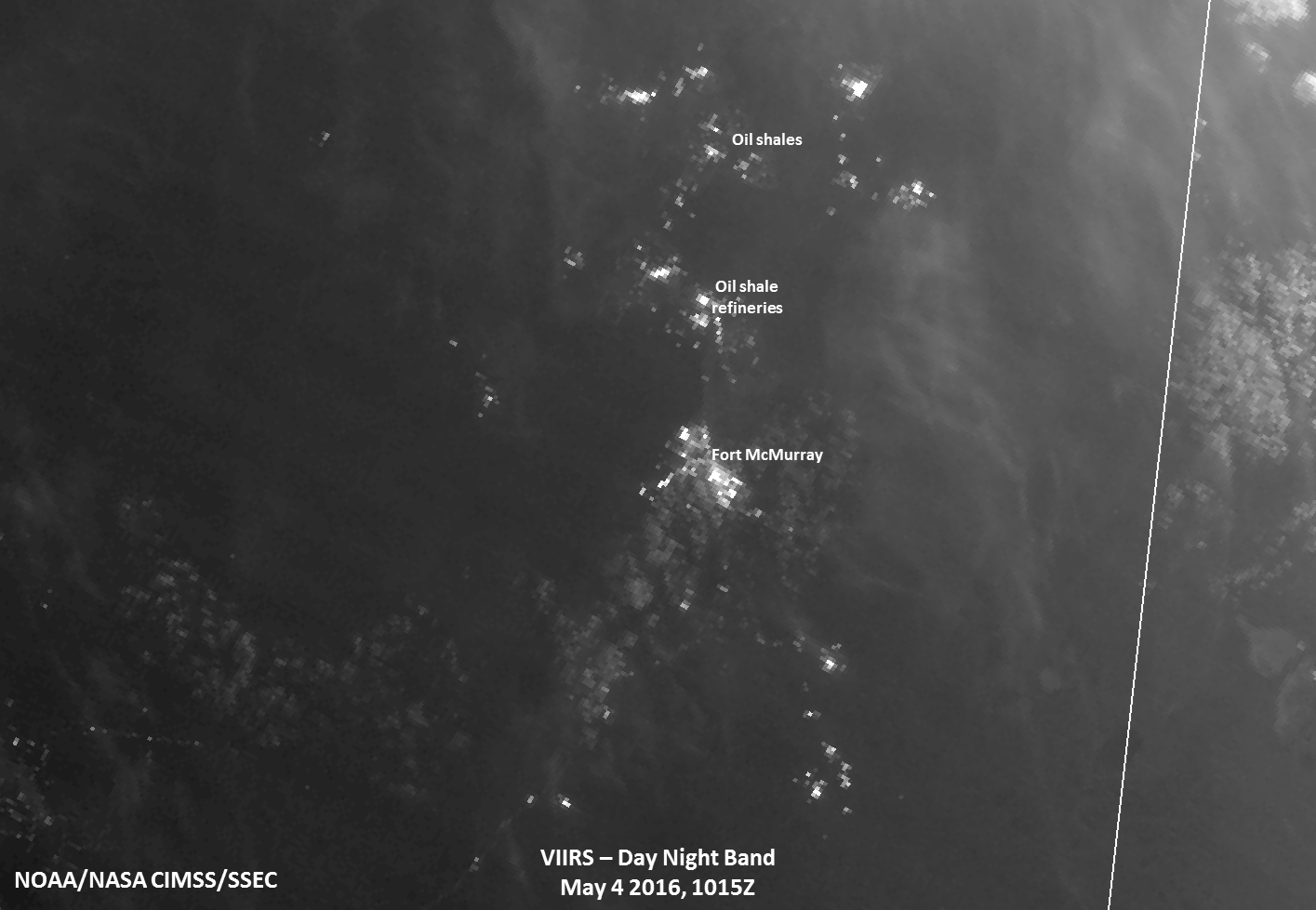
Animation showing the progress of the fire, as captured by the VIIRS Day/Night Band, from May 4-10.
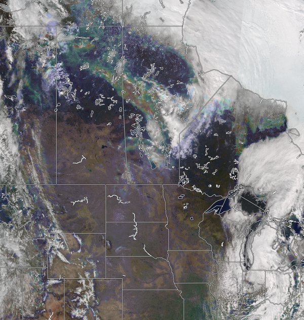
An overlay of the VIIRS True Color and the VIIRS Aersol Optical Depth (rainbow), which shows the smoke plume early in the life of the Fort McMurray fire. (Courtesy Russell Dengel and RealEarth, SSEc, University of Wisconsin-Madison)
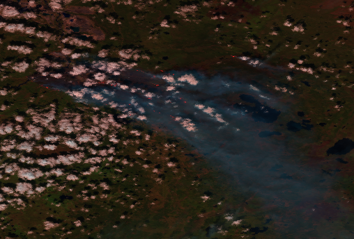
An RGB image created using VIIRS I bands 3-2-1. Active Fire detections are shown as red dots. An overlay of the VIIRS True Color and the VIIRS Aersol Optical Depth (rainbow), which shows the smoke plume early in the life of the Fort McMurray fire. (Courtesy Ivan Csiszar)
