Hurricane IRMA
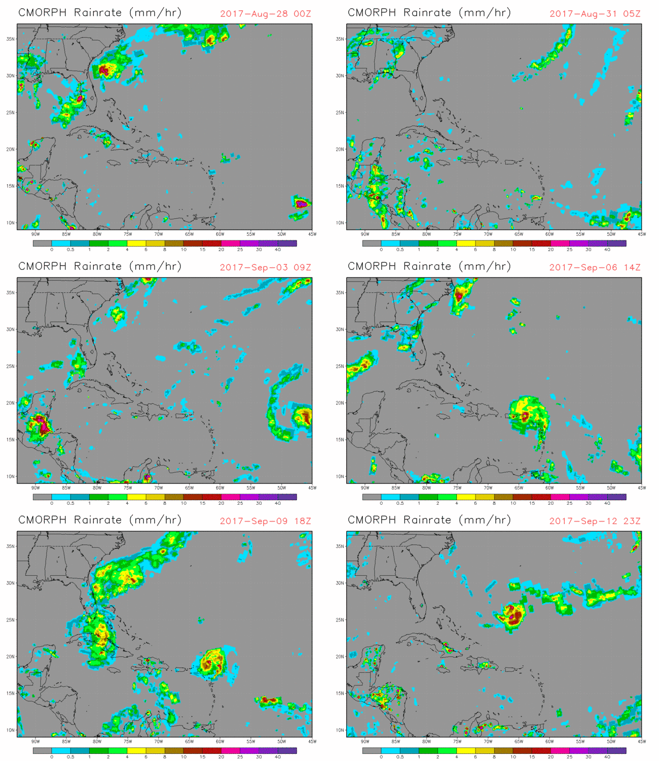
IRMA Animation, CMORPH Rain Rate since Aug 28, 2017
CMORPH Rain Rate: a blended product, uses multiple JPSS products as inputs.
Thanks and credit: NCEP/CPC, Pingping Xie. Click images to enlarge.
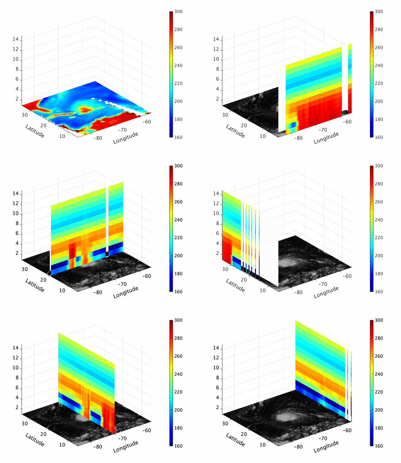
IRMA Animation, Limb Corrected ATMS TDR, 7 September, 2017
Thanks and credit: Lihang Zhou, Kexin Zhang. Click images to enlarge.
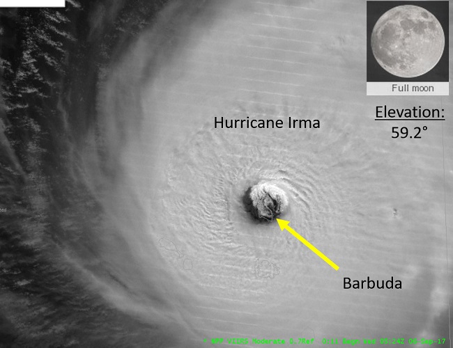
VIIRS Near-Constant Contrast DNB Image - 6 September 2017, 05:24 Z (9:24 am EST)
Near-Constant Contrast (NCC) satellite image of Hurricane Irma at 0524Z, 6 September 2017 as it approaches Puerto Rico. The NCC is a derived product of the Day/Night Band sensor that utilizes a sun/moon reflectance model that illuminates atmospheric features, senses reflected and emitted light sources, and assists with cloud monitoring during the nighttime. In the image, notice the island of Barbuda is located in the eye-wall of the hurricane. In the top- right corner of the image, the moon percent visibility and moon elevation angle are provided. A full moon present and a positive moon elevation angle imply that the moon was above the horizon, and provided adequate reflected moonlight of the ambient atmospheric features.
Thanks and credit: Jorel Torres (CIRA). Click images to enlarge.
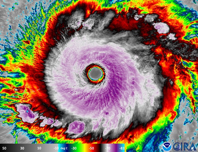
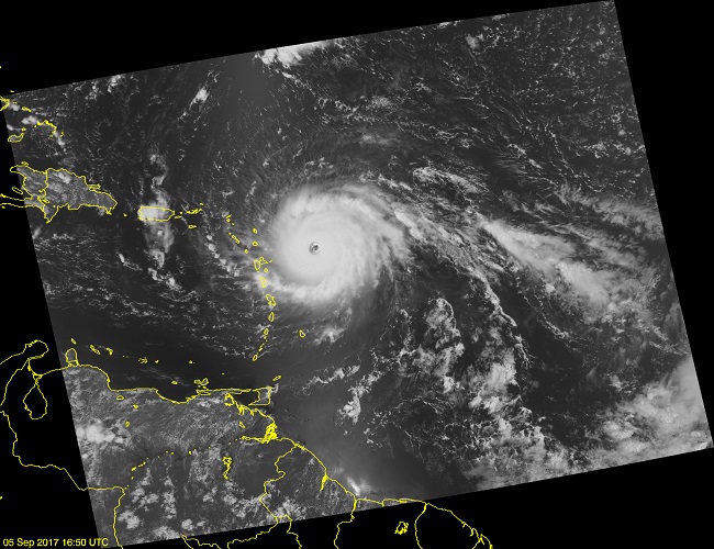
VIIRS Infrared Image of Irma - 6 September 2017
Hurricane Irma, at that point east of the Leeward Islands at at 16.88 N 58.97 W, produced from the S-NPP VIIRS instrument using the I band.
Thanks and credit: RAMMB/CIRA. Click images to enlarge.
VIIRS Day-Night Band Image of Irma - 6 September 2017
Hurricane Irma as it moves toward Puerto Rico. This image is produced from the S-NPP VIIRS instrument using the Day-Night band.
Thanks and credit: JPSS EDR Team / Ryan Smith. Click images to enlarge.
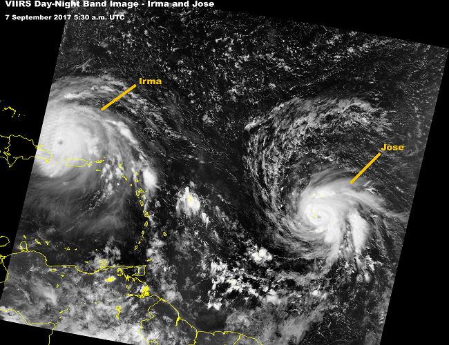
VIIRS Day-Night Band Image of Irma and Jose - 7 September 2017
Hurricane Irma on the left, northwest of Puerto Rico. Hurricane Jose much farther east. Image produced from the S-NPP VIIRS instrument using the Day-Night band.
Thanks and credit: JPSS EDR Team / Ryan Smith. Click images to enlarge.
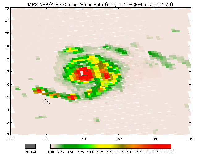
MiRS Graupel Water Path, ascending - 5 September 2017
Thanks and credit: MiRS Team / Christopher Grassotti, Quanhua Liu, Junye Chen, Shuyan Liu. Click images to enlarge.
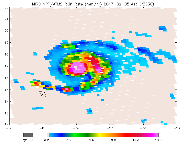
MiRS Rain Rate, ascending - 5 September 2017
Thanks and credit: MiRS Team / Christopher Grassotti, Quanhua Liu, Junye Chen, Shuyan Liu. Click images to enlarge.
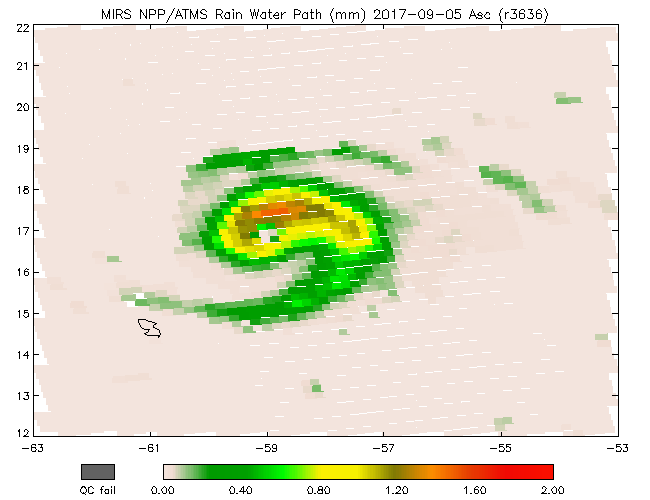
MiRS Rain Water Path, ascending - 5 September 2017
Thanks and credit: MiRS Team / Christopher Grassotti, Quanhua Liu, Junye Chen, Shuyan Liu. Click images to enlarge.
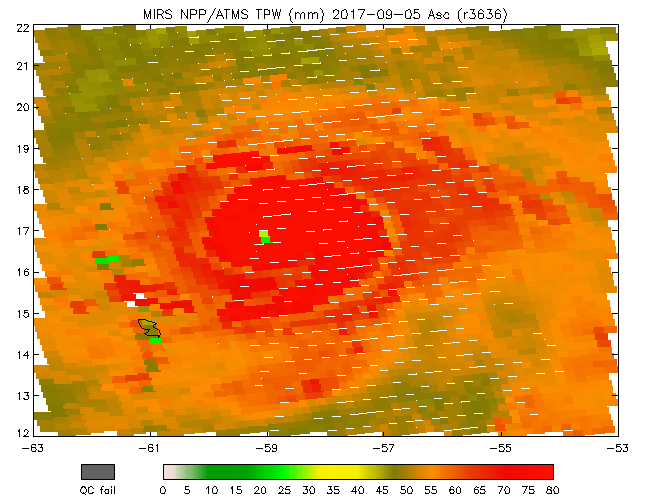
MiRS TPW, ascending - 5 September 2017
Thanks and credit: MiRS Team / Christopher Grassotti, Quanhua Liu, Junye Chen, Shuyan Liu. Click images to enlarge.
Harvey and IRMA: A View from NUCAPS and MiRS
Thanks and credit: Tony Reale, Bomin Sun, Mike Pettey and Ryan Smith
Hurricanes Irma and Katia: Stability IndicesThanks and credit: Flavio Iturbide-Sanchez, Silvia Regina Santos da Silva, Antonia Gambacorta, Nicholas Nalli, and Changyi Tan

