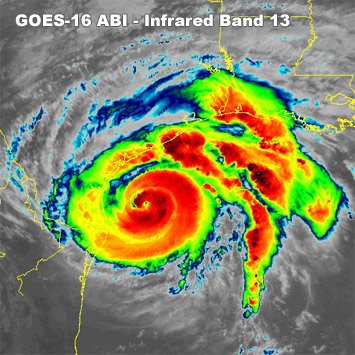
Hurricane Harvey Hits the Texas Coast

25 August 2017 -
Hurricane Harvey made landfall midway along the Texas coast
between late Friday night on 25 August 2017. GOES-16 imagery of the
storm is shown above in geocolor and from infrared band 13.
Harvey produced over 50 inches of rainfall over parts of the Houston metropolitan area,
and even now (5 September 2017) flood waters have not completely subsided, and damage
estimates are in the hundreds of billions of dollars.
Special thanks to RAMMB/CIRA and STAR IT for image animation and geocolor
development support.
NOAA's GOES-16 satellite has not been declared operational. Its data
are preliminary and undergoing testing.
|

