Microwave Surface and Precipitation Products System (MSPPS)
Algorithm Description
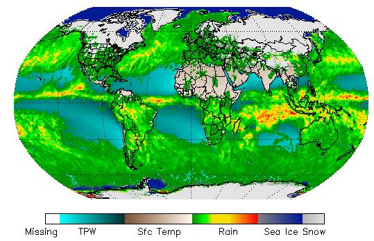
The operational Microwave Surface and Precipitation Products System (MSPPS) provides near real-time surface precipitation products using antenna temperatures from the AMSU-A and AMSU-B/MHS instruments on board of NOAA's KLMNN' and EUMETSAT’s Metop series of polar orbiting satellites. This set of products was the first of their kind as NOAA entered the NOAA-K era.
The current operational MSPPS products include: rain rate, snowfall rate, total precipitable water, cloud liquid water, snow cover, snow water equivalent, sea ice concentration, ice water path, land surface emissivity (23.8 GHz, 31.4 GHz, and 50.3 GHz), and land surface temperature. Algorithms for the products are a series of physically based retrieval algorithms; most recent update occurred in 2010, except for the snowfall rate, which was added about 5 years ago.
The operational orbital MSPPS data are available in HDF-EOS format, and some of products are also available in BURF format. The MSPPS retrospective data can be acquired from the National Climatic Data Center and the Comprehensive Large Array-data Stewardship System.
Main Applications:
The MSPPS products have essentially been replaced by the Microwave Integrated Retrieval System (MiRS) suite of products, however, some of the MSPPS products are still critical for NOAA operations because several are produced at the AMSU-B/MHS (16 km) resolution whereas not all of the operational MiRS products are yet produced at high resolution. In addition, the MSPPS has a snowfall rate product which at this writing, is still being transitioned into the MiRS framework. Once both of these occur, the MSPPS products will not be critical for operational use, however, the long standing time series itself will remain useful.
The MSPPS product suite has historically been used by a number of NOAA users to compliment similar products generated from other polar orbiting satellites such as the DMSP and JPSS series. This then provides a much greater sampling of the diurnal cycle globally, thus providing a much more complete representation of products related to the hydrological cycle. For example, NWS’s CMORPH rain product – merged passive microwave and IR product – greatly relies on MSPPS (and eventually, MiRS) rain and snow rates. Other NESDIS operational products have used MSPPS (and now transitioning to MiRS) include eTRaP, bTPW, and bRR.
Key Users:
- NOAA/NWS – NCEP (primarily CPC and NHC);
Forecast offices (AWIPS); NASA/GPM program
Operational Product Access
List of satellite/instruments for algorithm
- NOAA-15
- NOAA-16
- NOAA-17
- NOAA-18
- NOAA-19
- Metop-A
- Metop-B AMSU-A
- Metop-B AMSU-B
- MHS

