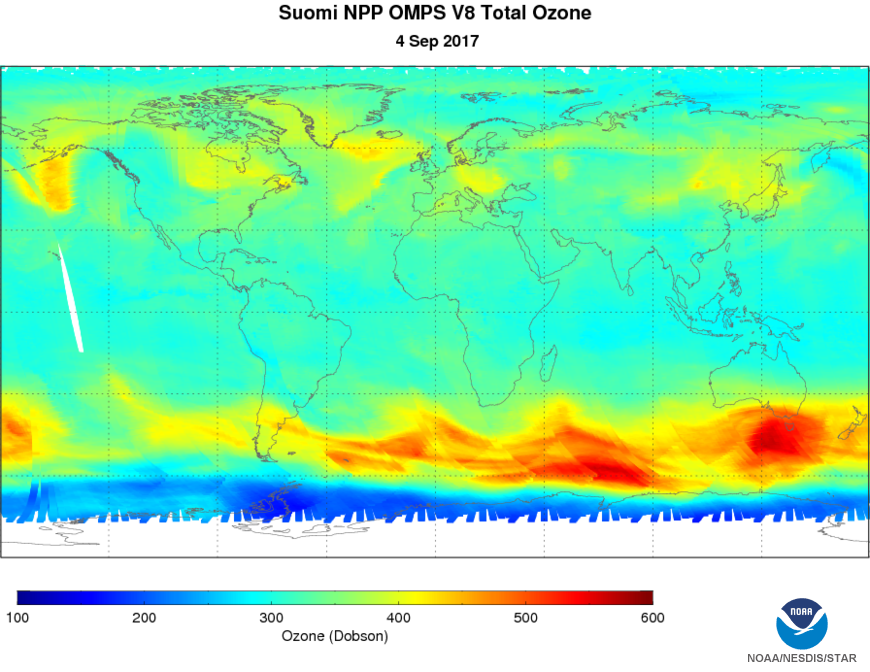
Ozone Mapping and Profiler Suite (OMPS) Environmental Data Records (EDRs)
Algorithm Description
OMPS is a three-part instrument that measures global ozone. The Nadir Mapper maps ozone with an approximate 50-km ground-resolution. The Nadir Profiler measures the vertical distribution of ozone in the stratosphere. The Limb Profiler measures ozone in the lower stratosphere and troposphere with high vertical resolution.
Ozone profiles and total column amounts are derived from the ratio of the observed backscattered spectral radiance to the incoming solar spectral irradiance. The Ozone Nadir Profile is an EDR created from measurements made by the OMPS Nadir Profiler and the OMPS Nadir Mapper sensors. It continues the heritage from NOAA POES SBUV/2, EOS-AURA OMI and SOLSE/LORE. The OMPS products provide global daily monitoring of the three dimensional distribution of ozone and other atmospheric constituents. Version 8 of the nadir ozone profile algorithm (V8Pro) was developed by NASA for use in the NOAA SBUV/2 program and it is implemented in the JPSS system. The Version 8 total ozone algorithm (V8TOz) and the Linear Fit SO2 (LFSO2) algorithm were developed by the NASA OMI Science Team. The V8Pro, V8TOz, and LFSO2 algorithms are implemented in NDE2.
Main Applications:
Ozone products are used in monitoring the ozone hole and ozone trends, as well as in monitoring volcanic hazards. OMPS products are now also used to help with ultraviolet index forecasts. Knowing the vertical structure of ozone is helpful in understanding atmospheric chemistry and the interaction between ozone and other atmospheric gases.
Key Users:
- NCEP/CPC
- NCEP/EMC
- NRL
- International NWP Users
- WMO Ozone Assessment
Algorithm PI
Principal Investigator
Larry Flynn (STAR)
Operational Product Access
Monitoring and Algorithm Support
List of satellite/instruments for algorithm
- S-NPP (OMPS)
- NOAA-20 (OMPS)

