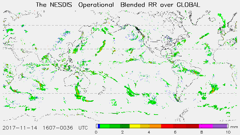
Blended Rain Rate (bRR)
Algorithm Description
The blended rain rate (RR) product is produced hourly by blending together recent rain rate retrievals from passive microwave instruments on eight polar-orbiting satellites, including POES NOAA-18, NOAA-19 and Metop-A, and also DMSP F16, F17 and F18; GCOM-W1 AMSR-2 and GPM GMI. The blended RR eliminates the bias between those data sets and provides a unified, meteorologically significant rain rate field for satellite analysts and weather forecasters. The product is generated with the latest 12 hours’ worth of rain rate retrievals from multi-satellites/algorithms and output with a Mercator projection with 16-km resolution at the equator.
Main Applications:
The product is converted into McIDAS format for NESDIS satellite analysts and is subset into 4 AWIPS regions (Super National, Alaska, Hawaii, Puerto Rico) for NWS forecasters.
Key Users:
- NOAA/NWS/Forecast offices and national centers.
MiRS key users include the National Hurricane Center (NHC) who utilizes the an algorithm for tropical cyclone intensity estimates that use as inputs MiRS profiles of temperature and water vapor. NHC also uses the Blended TPW and Layer Water Vapor products which are derived from inputs of MiRS water vapor profiles. The Weather Prediction Center also uses both Blended TPW and Layer Water Vapor in their operational forecasting activities. The Climate Prediction Center uses MiRS precipitation rate in their global high resolution blended precipitation analyses (CMORPH) that are updated every 30 minutes.
Algorithm PI
Principal Investigator
Ralph Ferraro, NESDIS/STAR
Operational Product Access
STAR Monitoring and Algorithm Support
To be supplied
List of satellite/instruments for algorithm
- NOAA-18
- NOAA-19
- Metop-A
- Metop-B – MHS
- DMSP
- F-16
- F-17
- F-18 SSMIS
- GCOM-W1 AMSR-2
- GPM GMI

