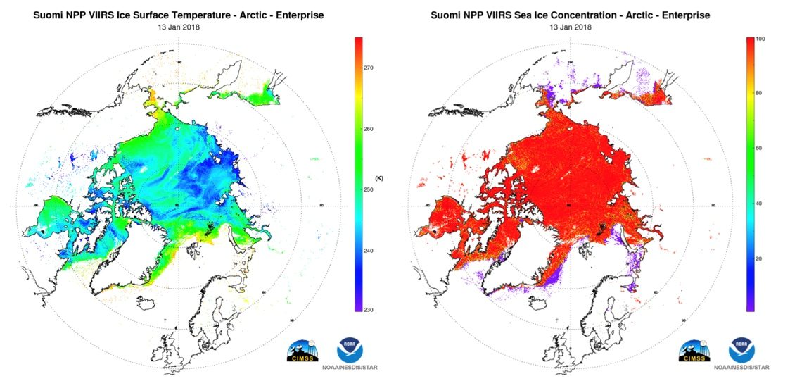
Figure: VIIRS ice surface temperature (left) and ice concentration (right) over the Arctic on January 13, 2018.
Snow and Ice Products
Algorithm Description
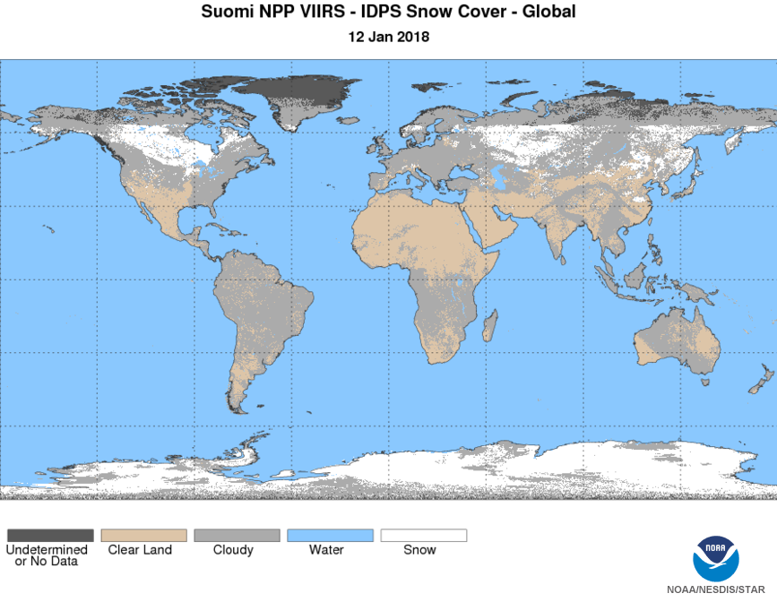
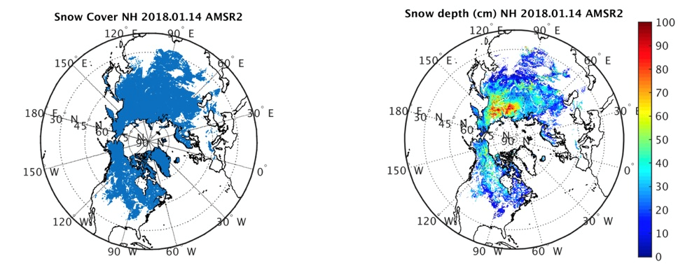
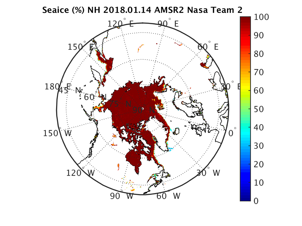
Visible Infrared Imaging Radiometer Suite (VIIRS) ice products include ice surface temperature (IST), ice concentration, and ice thickness/age. IST is a “skin” temperature, i.e., the radiating temperature of the surface of sea and lake ice. Ice concentration is the fractional coverage of ice in each pixel. Ice thickness/age is an estimate of the thickness of sea and lake ice, and an age category based on thickness. VIIRS snow products are a binary snow cover map and snow fraction. Snow fraction is the fraction of each pixel covered by snow. GOES-16 Advanced Baseline Imager (ABI) cryosphere products are fractional snow cover, ice concentration, ice thickness/age, and ice motion. The ice motion product gives the speed and direction of ice movement in the ocean and inland lakes. The Advanced Microwave Sounding Radiometer 2 (AMSR2) onboard the first Global Change Observation Mission – Water (GCOM-W1) satellite includes similar microwave frequencies that have been used for snow and sea ice retrievals from previous sensors, providing the continuous and consistent long-term record of sea ice beginning in late 1978. The snow products from AMSR2 include binary snow cover (presence/absence of snow), snow depth, and snow water equivalent. AMSR2 sea ice products are sea ice concentration (SIC), multi-year ice concentration (MYIC), and several quality indicator fields.
Main Applications
Ice products have two primary operational uses: navigation and numerical weather prediction (NWP). At present, their use in NWP is limited. Snow products are used in NWP. Both snow and ice products are important in climate studies.
Key Users
- National Ice Center (NIC)
- Alaska Sea Ice Program (ASIP)
- Naval Oceanographic Office (NAVOCEAN)
- National Centers for Environmental Prediction (NCEP)
Algorithm PI
Principal Investigator
Jeff Key, NESDIS/STAR
Operational Product Access
STAR Monitoring and Algorithm Support
Relevant External Links
- VIIRS Ice Products
- Recent GCOM-W1 AMSR2 Snow and Sea Ice Products
- JPSS Snow Cover
- JPSS Sea Ice
- JPSS Ice Surface Temperature
List of satellite/instruments for algorithm
- S-NPP VIIRS
- GOES-16 ABI
- NOAA-15, -18, and -19 AVHRR
- Terra and Aqua MODIS
- GCOM-W1 AMSR2


