Ocean Topography and Cryosphere Branch / Laboratory for Satellite Altimetry / Sea Level Rise
Sea level rise
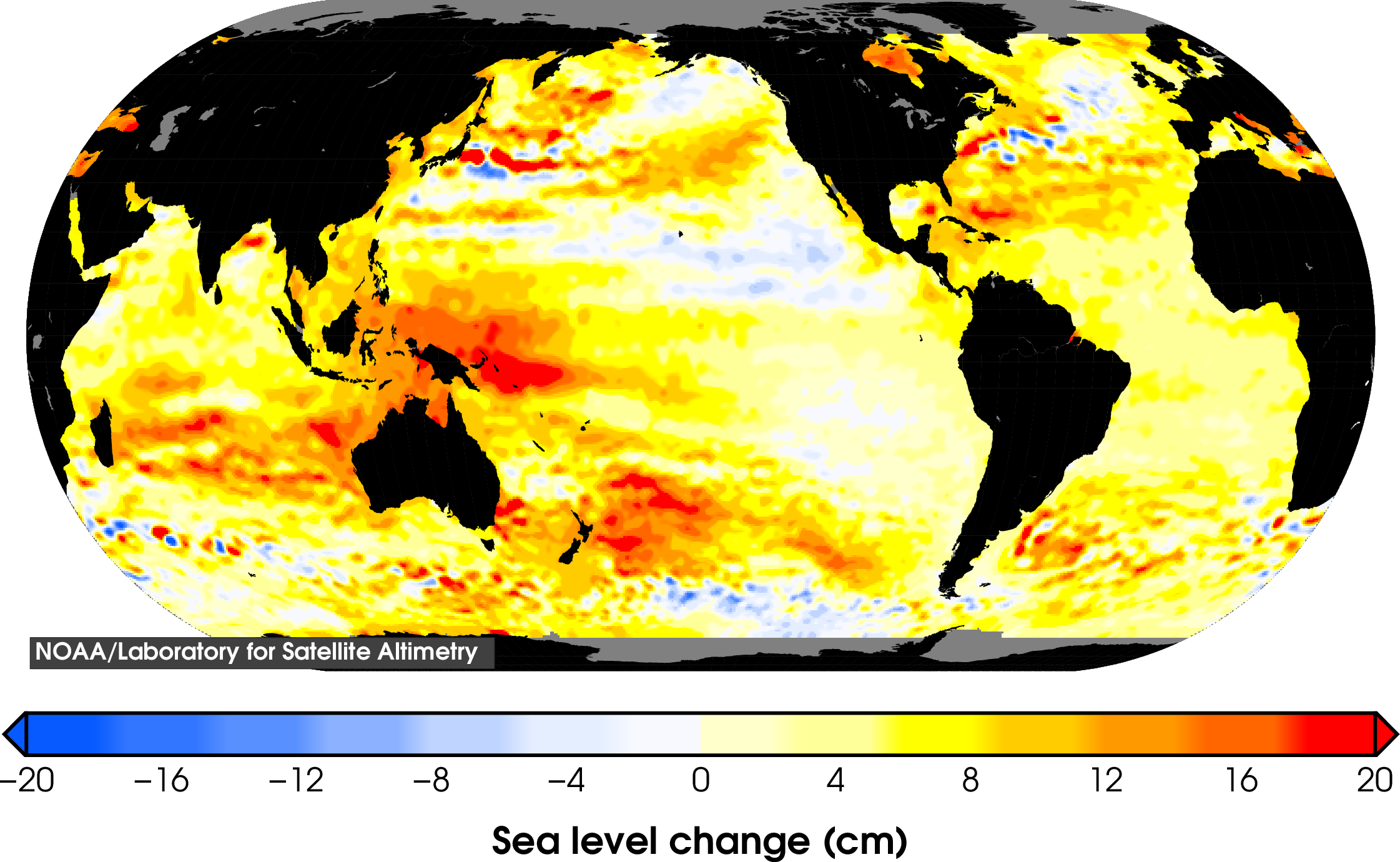
One of the most significant potential impacts of climate change is sea level rise that may cause inundation of coastal areas and islands, shoreline erosion, and destruction of important ecosystems such as wetlands and mangroves. As global temperatures increase, sea level rises due to a thermal expansion of upper layers of the ocean and melting of glaciers and ice sheets.
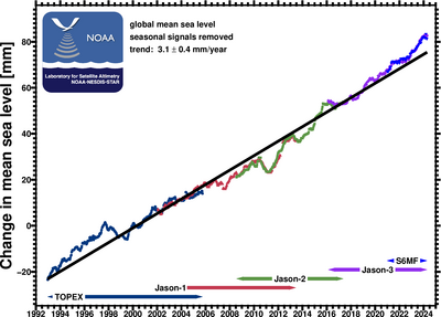
The measurement of long-term changes in global mean sea level can provide an important corroboration of predictions by climate models of global warming. Satellite altimeter radar measurements can be combined with precisely known spacecraft orbits to measure sea level on a global basis with unprecedented accuracy. A reference series of satellite missions that started with TOPEX/Poseidon (T/P) in 1992 and continued with Jason-1 (2001–2013), Jason-2 (2008–2019), Jason-3 (2016–present), and Sentinel-6MF (2020–present) estimate global mean sea level every 10 days with an uncertainty of 3–4 mm.
Jason-3, launched 17 January 2016, is a joint effort between NOAA, the National Aeronautics and Space Administration, France’s Centre National d’Etudes Spatiales (CNES) and the European Organisation for the Exploitation of Meteorological Satellites (EUMETSAT).
The latest mean sea level time series and maps of regional sea level change can be found on this site.
Global mean sea level from the reference series of altimeter missions
Total sea level change since 1993