

|
Data and images displayed on STAR's sites are provided for experimental use only and are not official operational NOAA products. More information>> |
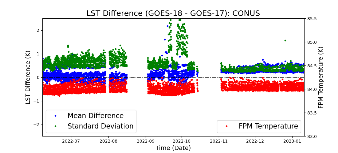
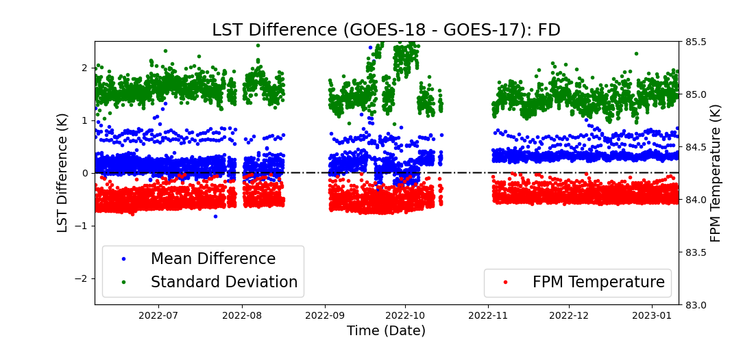
Inter-sensor LST Comparison: GOES-18 vs. GOES-17Note: some GOES-17 results may be degraded due to overheating of its ABI sensor. GOES-18 completed its westward drifting and stayed at 136.8º W on June 7th, 2022. Its view geometry at the new location is very similar to that of the GOES-17 (located at 137.2º W). Products from both platforms are operationally projected to the same GOES-WEST localtion at 137º W, and thus share the same coordinate system. The following shows a direct comparison of their land surface temperature products for the most recent week including both CONUS and Full Disk coverages. Three indices are provided:
   |
|
|
|
