
|
GOES-15 Visible Images | GOES-15 IR Images GOES-15 First Images Transmitted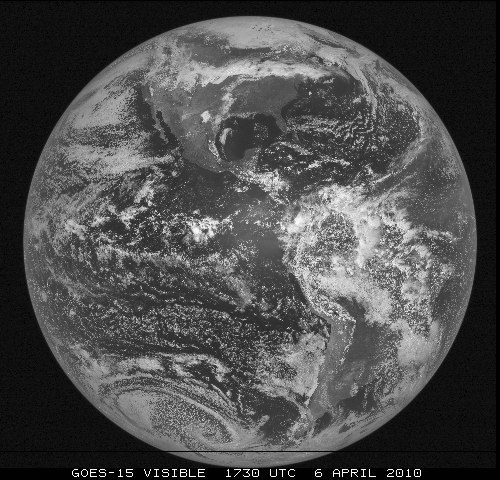
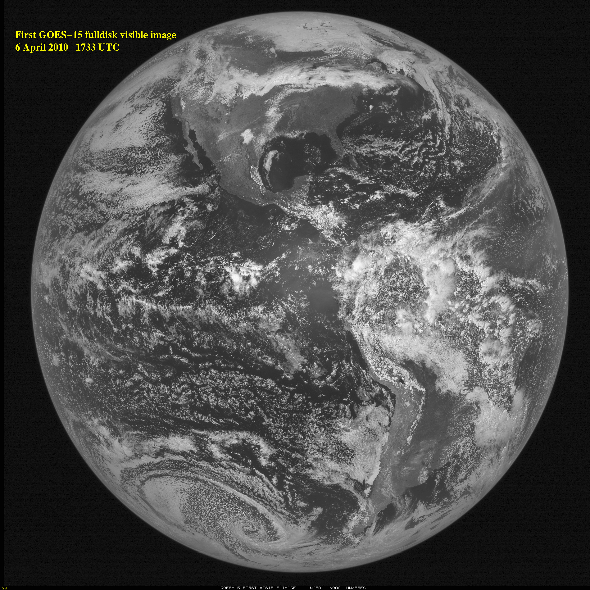
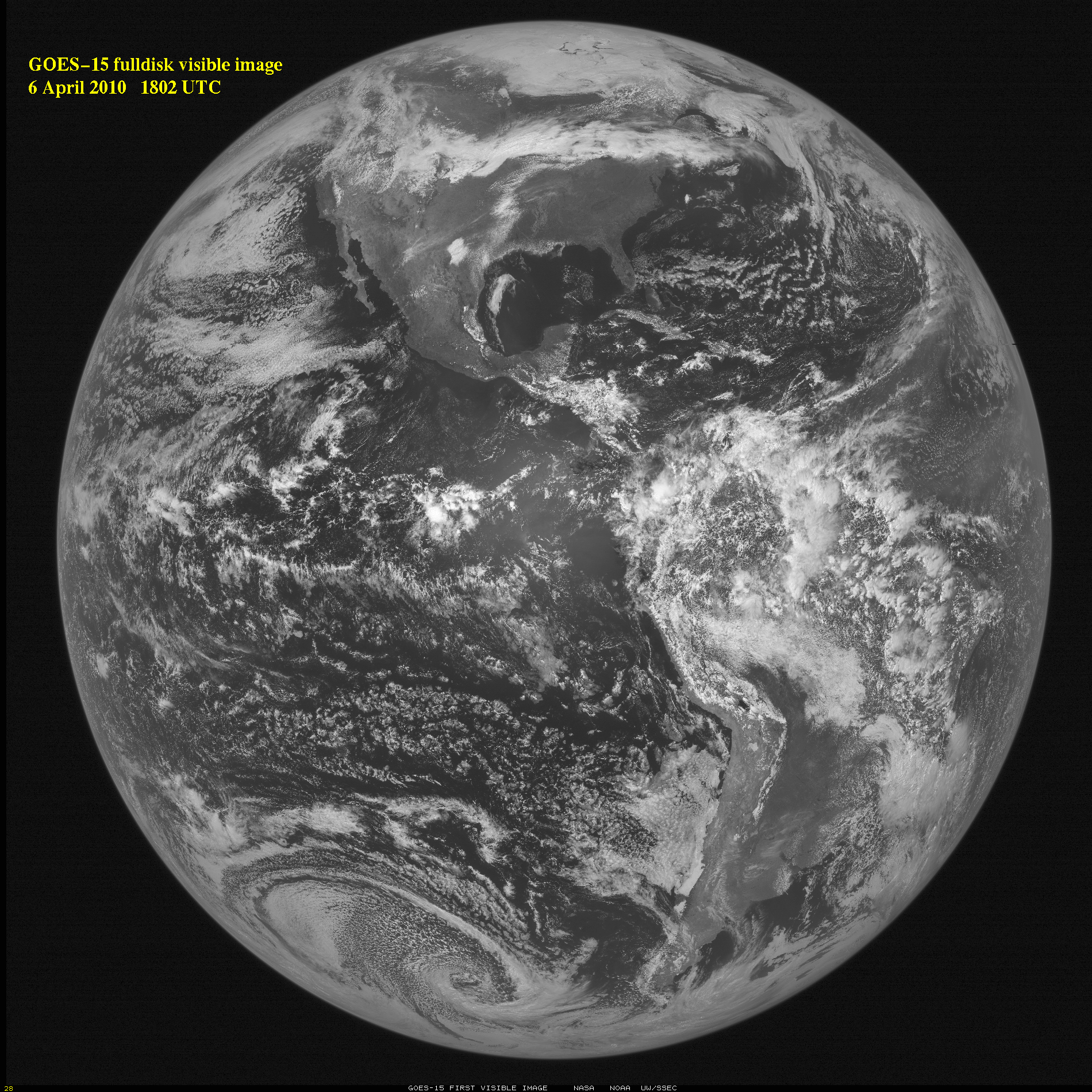
From approximately 22,236 miles in space, NOAA's newest Geostationary Operational Environmental Satellite - GOES-15 - took its first full visible image of the Earth on April 6, 2010 at 1:33 p.m. EDT.6 April 2010 - GOES-P was launched by NASA on 4 March 2010 and has successfully reached geostationary orbit to become GOES-15, the latest in the long line of GOES which started with the SMS/GOES program in the mid-1970s. GOES-15 is the last in the current GOES series, to be followed by the next generation GOES-R in late 2015. The first full-disk visible image from GOES-15, captured on On 6 April 2010 at 1730 UTC, is shown. The Sounder also acquired visible images. This will be followed by the first infrared (IR) images in late April. Testing of the spacecraft and its instruments will continue through the entire Post Launch Test (PLT) period. The last part of that PLT period will be the NOAA Science Test, during which the satellite instrumentation will be controlled to provide special data. The Science Test is currently scheduled for the summer of 2010. Operational scenarios and special imagery will be collected, to test both Imager and Sounder characteristics and the generation of products from the GOES-15 data stream. STAR is leading the GOES-15 Science Test. Participants include scientists both inside and outside of NOAA. The results of the Science Test will be available on the GOES-15 Science Test page, and when finished, a NOAA Technical Report with Science Test findings will be published. Any scientists not already participating but interested in the Science Test data should contact either Don Hillger (STAR/RAMMB) or Tim Schmit (STAR/ASPB). The GOES (Geostationary Operational Environmental Satellite) series of U.S. satellites are developed by a joint NASA-NOAA-Industry partnership, launched by NASA (with industry partners), and operated by NOAA. GOES-15 ImprovementsIn general, GOES-13/14/15 are in the same 'class' (previously called GOES- N/O/P), but they are improved over the current operational GOES (11/12) series. In particular, changes implemented with GOES-14 and GOES-15 compared to previous GOES Imagers includes the following:
Learn more:
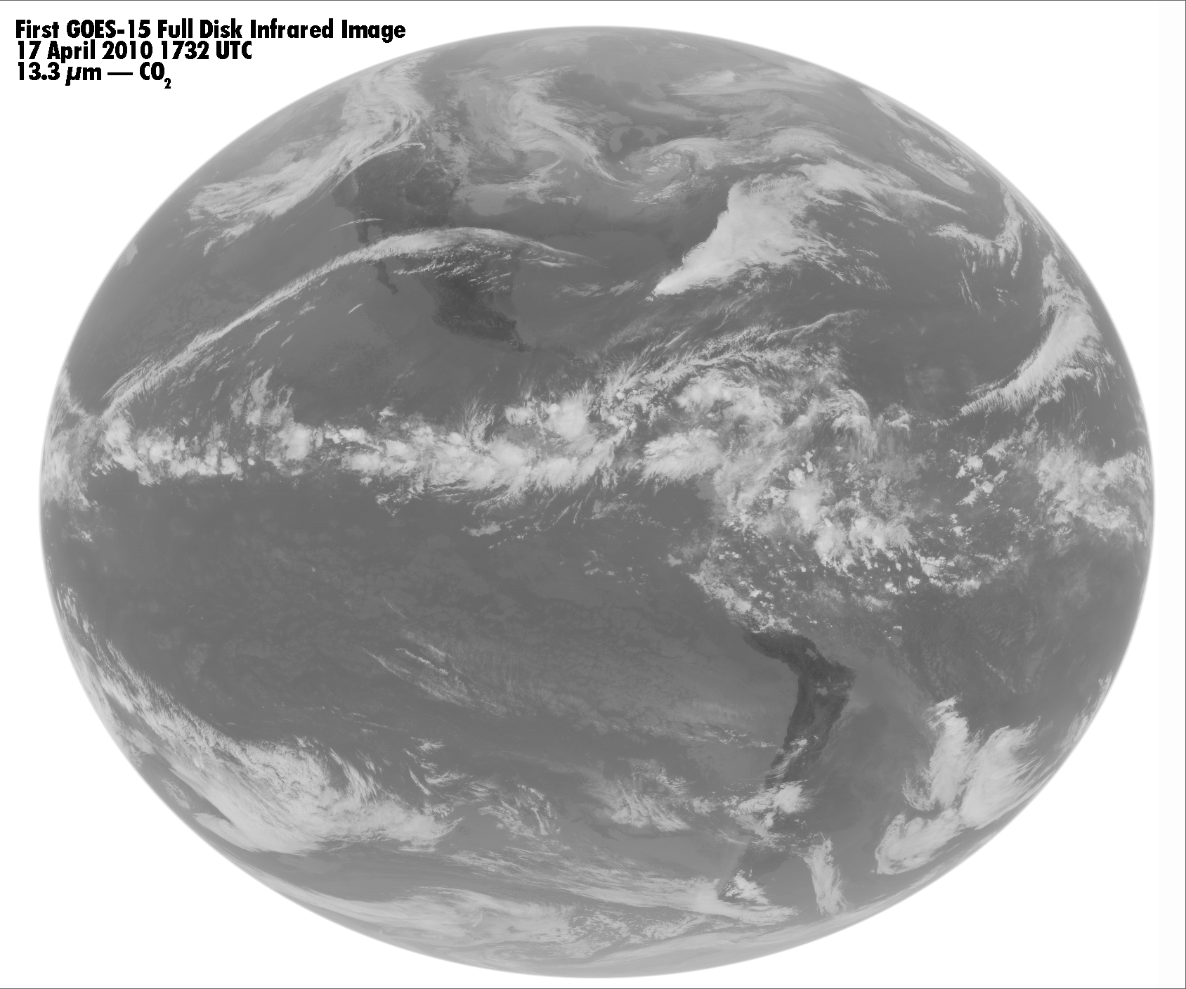
First GOES-15 Infrared Images Transmitted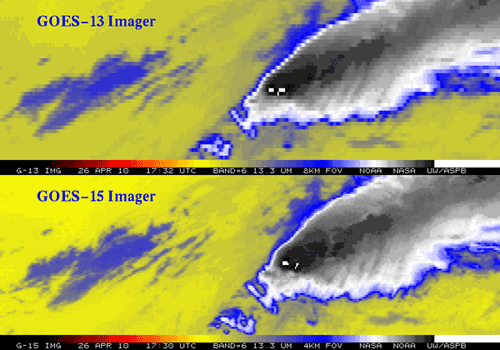
Image Compares GOES-15 to GOES-13 in Channel 6, CO2 band26 April 2010 - The first official full-disk infrared images from GOES-15 were sent down in GVAR format at 1730 and 1800 UTC today. See the GOES-15 Science Test page for images captured at both CIRA and CIMSS. The main part of the GOES-15 Science Test will commence on 7 August 2010. STAR scientists are key participants on the GOES-15 as well as on the GOES-14 science test teams. The image at right provides a side-by-side comparison of the resolution gain on the GOES-15 instrument over GOES-13. The spatial resolution of the 13.3 µm band (band-6) was improved from 8km to 4km, by incorporating two detectors instead of just one, producing a visibly smoother image resolution. 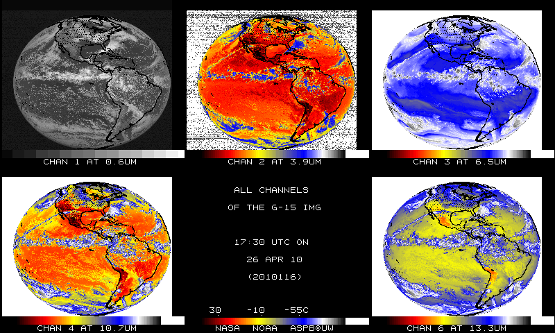
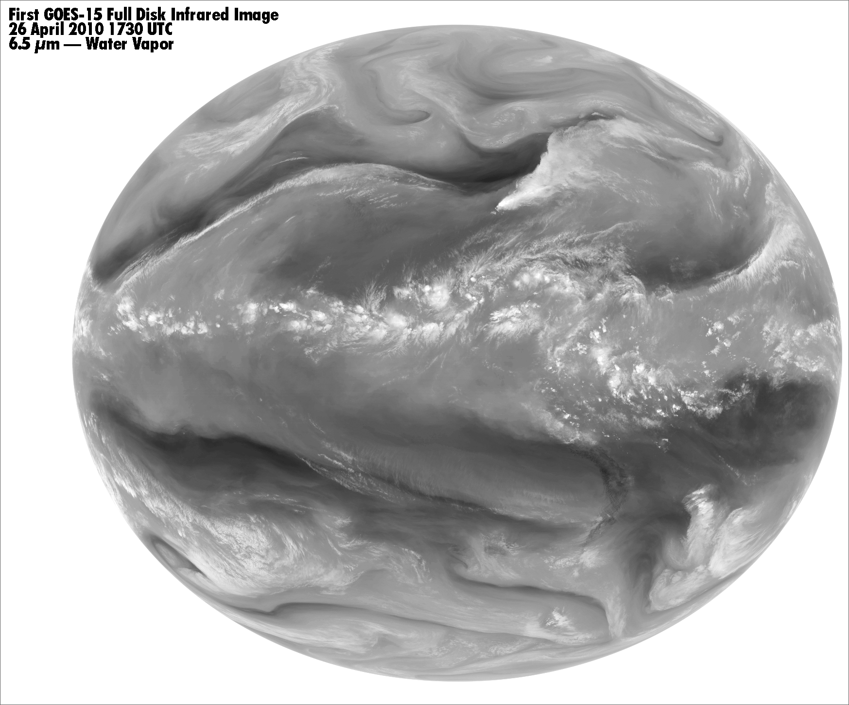
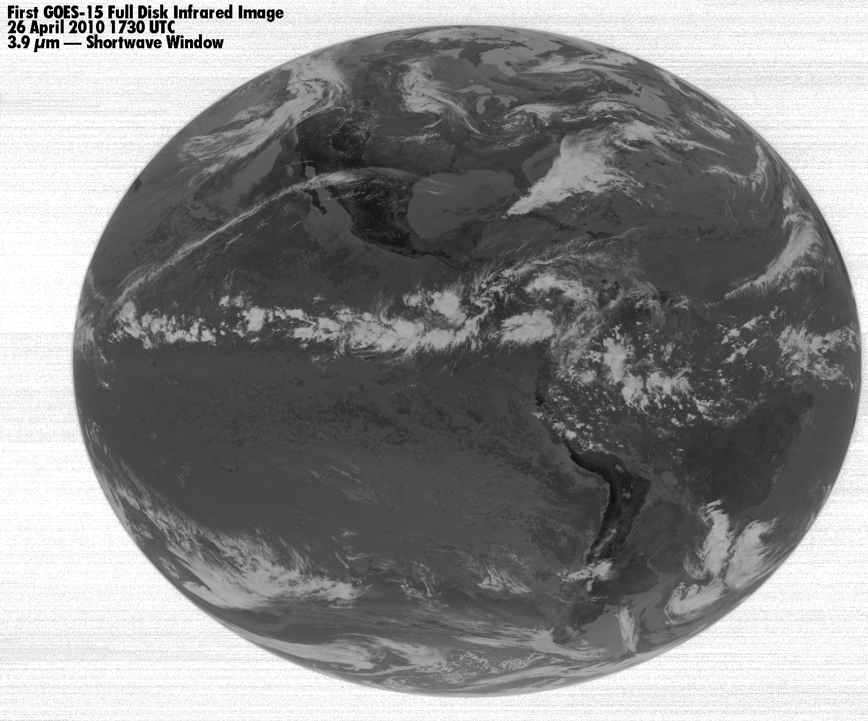
GOES-15 Image, April 26, 2010, 17:30 UTC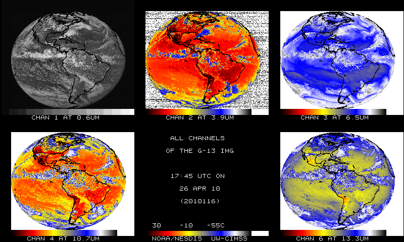
GOES-13 Image, April 26, 2010, 17:45 UTCShown from each satellite: Channel 1 at 0.6µm; Channel 2 at 3.9µm; Channel 3 at 6.5µm; Channel 4 at 10.7µm; Channel 6 at 13.3µm Click on the images below to see the full size image.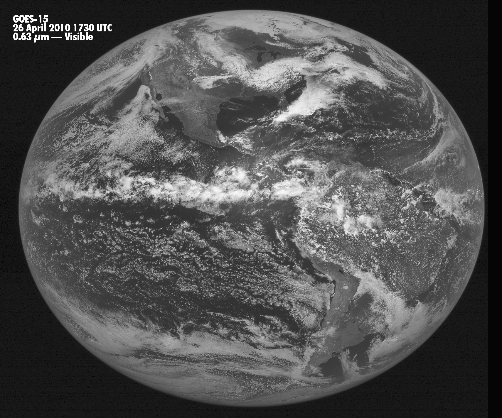
First GOES-15 Full Disk Infrared Image,
|
|