STAR Scientists Contribute to Improved Volcanic Ash Trajectory Predictions
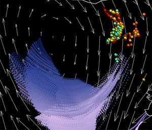
24-hour Volcanic Ash trajectory prediction associated with the
Eyjafjoll eruption in southern Iceland from IDEA-I valid at 06Z 5/7/2010.
Click the image to view a larger animated
version.
Developmental SEVIRI-based
Volcanic Ash Trajectory
Predictions 30 July 2010 - As part of
activities under the NOAA Volcanic Ash Working Group (VAWG) Science
Team, Advanced Satellite Products Branch (ASPB) scientists Brad Pierce
and Mike Pavolonis used aerosol trajectory forecast capabilities from
the International version of Infusing Satellite data into Environmental
Applications (IDEA-I) to demonstrate how Spinning Enhanced Visible and
Infrared Imager (SEVIRI) volcanic ash visible optical depth and ash top
pressure retrievals could be used to initialize volcanic ash trajectory
predictions associated with the April 2010 Eyjafjoll eruption in
southern Iceland. IDEA-I trajectory initialization software was adapted
for SEVIRI ash retrievals and delivered to scientists at the NOAA Air
Resources Laboratory (ARL) for use in Operational HYbrid Single-Particle
Lagrangian Integrated Trajectory (HYSPLIT) volcanic ash predictions.
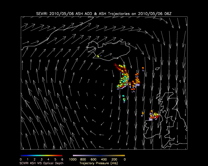
The IDEA-I trajectories are colored by their pressure (mb) and were
initialized using SEVIRI ash visible optical depth (colored circles) and
ash top pressure retrievals provided by Mike Pavolonis (NESDIS/STAR).
500mb wind predictions from the NWS Global Forecasting System (GFS) are
shown in white.
|