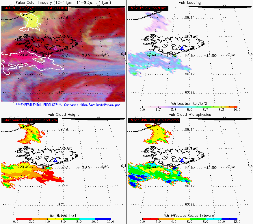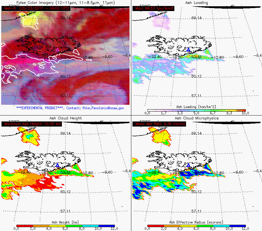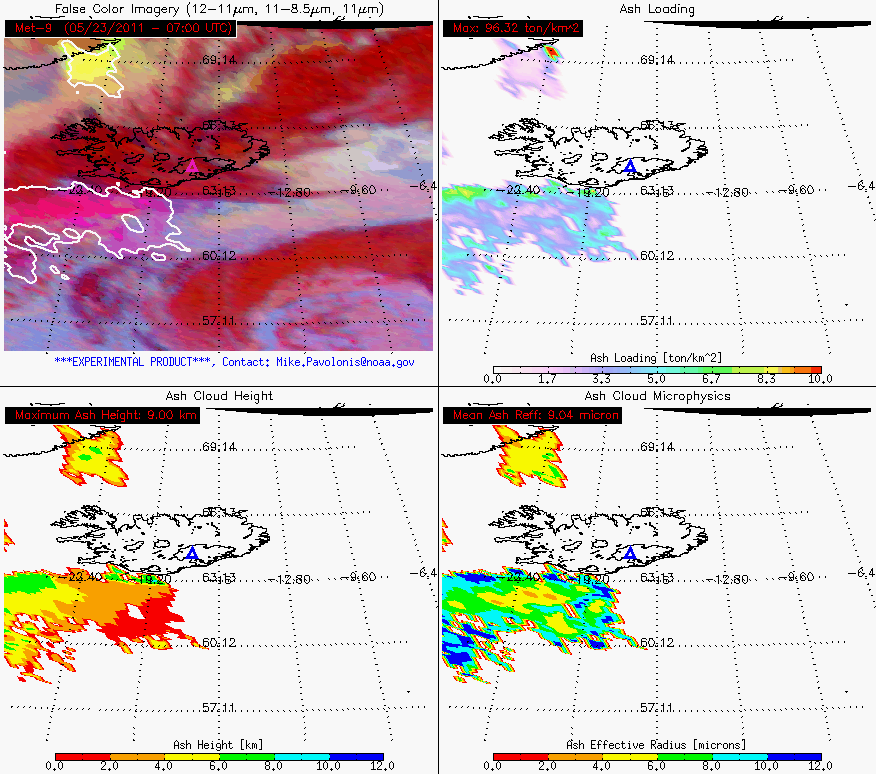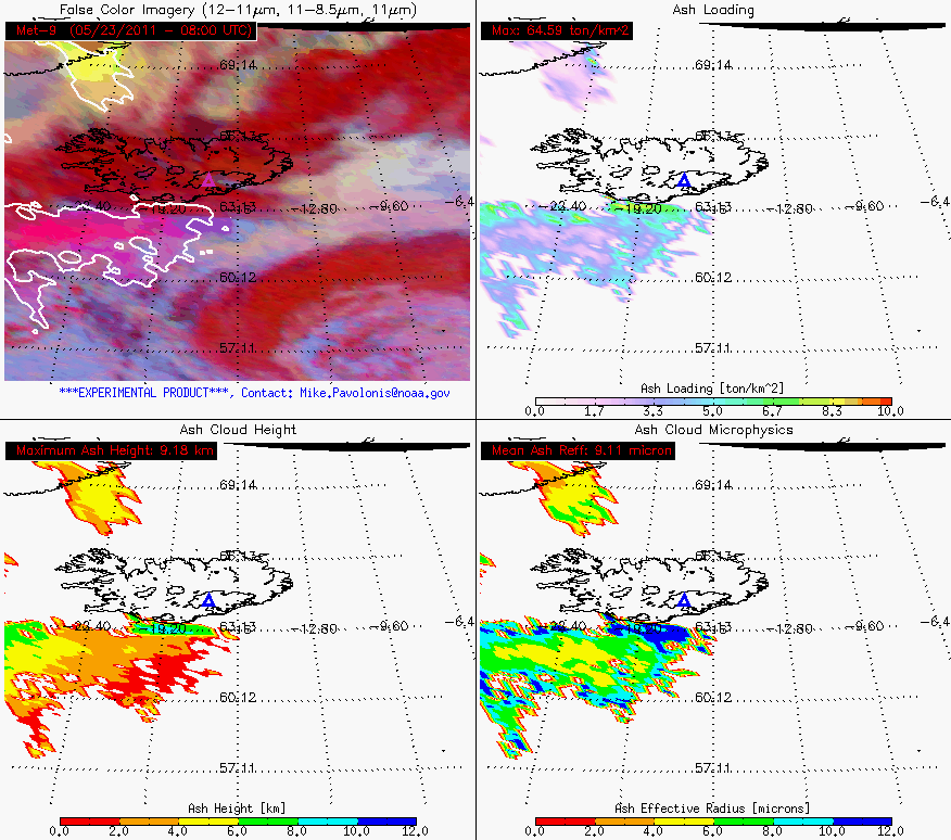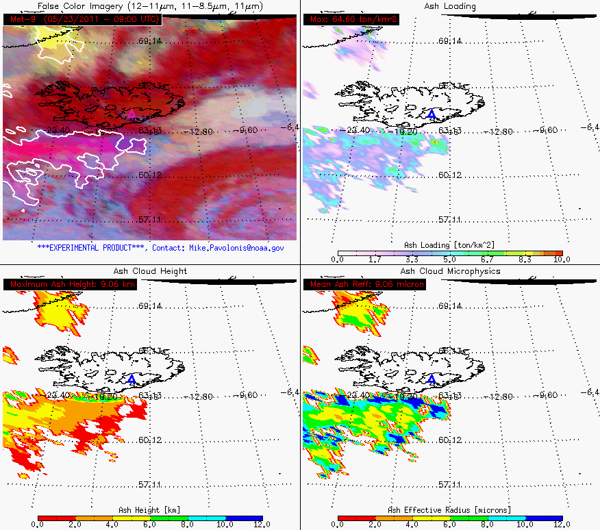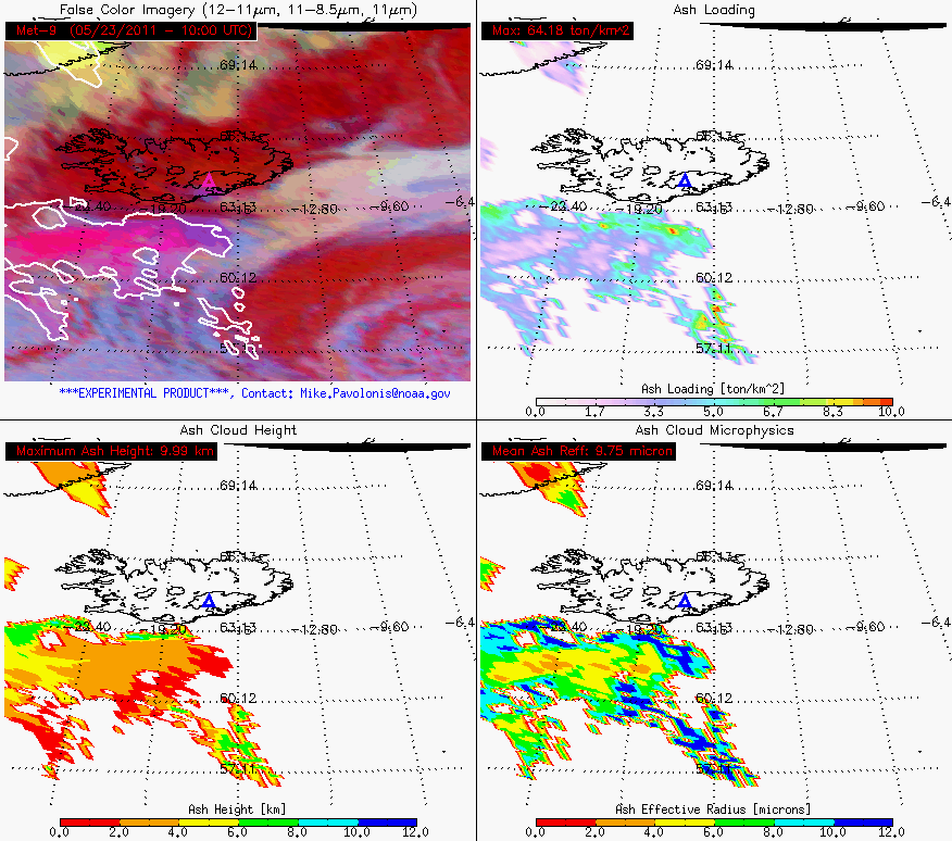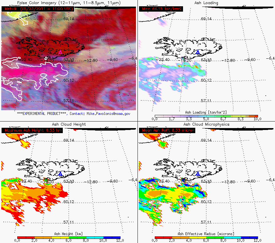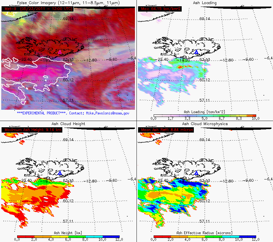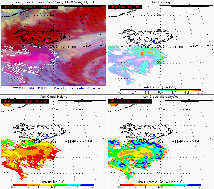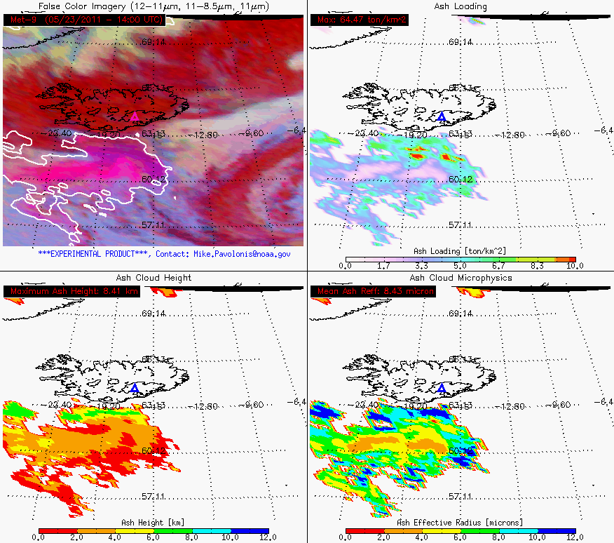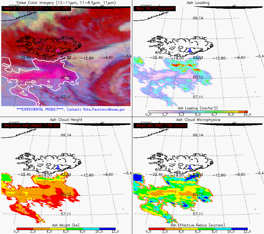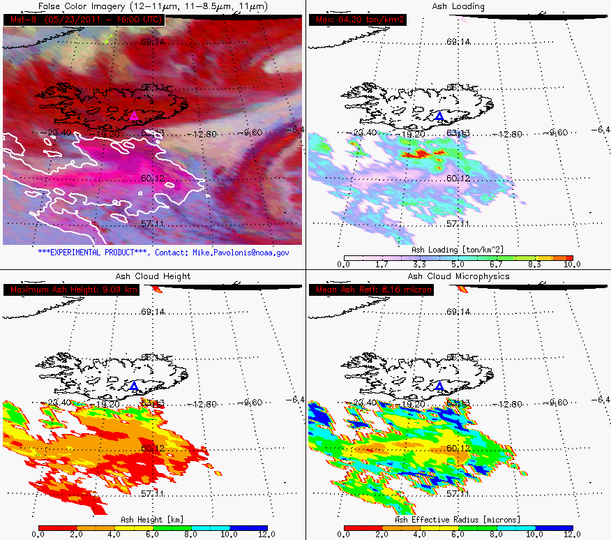
STAR Uses Near-Real-Time Satellite Products to Track Grimsvötn (Iceland) Volcanic Ash CloudsA 12-hour time lapse of the GOES-R volcanic ash products produced by STAR and CIMSS show volcanic ash from Grimsvötn moving southeast toward the United Kingdom on May 23, 2011. The ash cloud initially moved southwest of the volcano (the triangle) on May 21 and May 22, 2011, thereafter atmospheric winds began to move the cloud to the southeast (only the southeastward movement on May 23, 2011 is depicted in this loop). The GOES-R volcanic ash products provide information on the location of volcanic ash (upper, left), the amount of ash in the cloud (upper, right), the height of the ash cloud (lower, left), and the size of the particles in the ash cloud (lower, right). 23 May 2011 - One year after the end of the eruption of the Eyjafjallajokull Volcano in Iceland, which shutdown aviation over much of Europe and the North Atlantic, another Icelandic volcano began erupting on May 21, 2011. The Grimsvötn Volcano erupted for the first time since 2004, sending ash and volcanic gases up to 55,000 feet above mean sea level. So far, the eruption of Grimsvötn prompted the closure of Iceland's main airport and has disrupted some trans-atlantic flight routes. In support of NOAA's mission goal to provide accurate, timely, and integrated weather information to meet air and surface transportation needs, STAR scientists, in collaboration with the Cooperative Institute for Meteorological Satellite Studies (CIMSS), have been studying volcanic ash clouds and developing satellite based ash products. Volcanic ash products developed for the next generation of Geostationary Operational Environmental Satellite (GOES-R) can be generated using measurements from EUMETSAT's (The European Organization for the Exploitation of Meteorological Satellites) Spinning Enhanced Visible/Infrared Imager (SEVIRI). The GOES-R volcanic ash products are being generated over Iceland in near- realtime using SEVIRI as a proxy for GOES-R. The products are being made available to the international user community via the web at: https://cimss.ssec.wisc.edu/goes_r/proving-ground/geocat_ash/loops/iceland.html. The SEVIRI near-realtime product stream was set up in April 2010 at the request of the United Kingdom (UK) Met Office during the eruption of Eyjafjallajokull. The UK Met Office operates the London Volcanic Ash Advisory Center (VAAC). The London VAAC is responsible for advising aviation of the location and movement of volcanic ash clouds over much of the North Atlantic, including Iceland. The STAR GOES-R volcanic ash products provide unique information on ash cloud height, ash loading, and the size of the particles in the ash cloud, all of which are important for forecasting ash cloud dispersion. These same volcanic ash products are also being made available to the Anchorage VAAC in support of the GOES-R Proving Ground. The Anchorage VAAC, which is operated by the National Weather Service, is responsible for tracking ash clouds that are located over the North Pacific and Alaska. The STAR volcanic ash products will also be made available to the Washington VAAC in the near future. The Washington VAAC, which is operated by NESDIS, is responsible for a large area that stretches from the Western Pacific to the Central Atlantic. Credits & Links:
|
|
