NOAA-21 First Light Images!
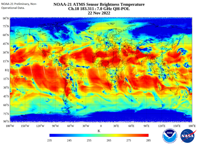
STAR JPSS has produced first light imagery from the recently launched NOAA-21 satellite. The image selected shows the Channel 18 (183 Ghz) Brightness Temperature for the ascending node on November 21-22. ATMS is the first NOAA-21 instrument to be activated.
Thanks and credit: STAR ATMS SDR Team. Click images to enlarge.
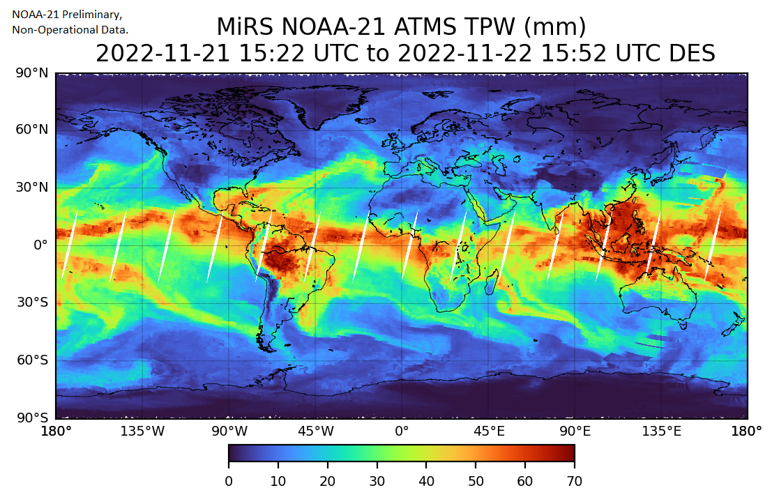
STAR JPSS has produced first light imagery from the recently launched NOAA-21 satellite. The image selected shows the ATMS-derived MIRS Total Precipitable Water for the ascending node on November 21-22. ATMS is the first NOAA-21 instrument to be activated.
Thanks and credit: STAR MiRS EDR Team. Click images to enlarge.
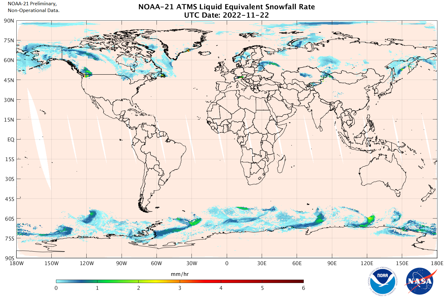
STAR JPSS has produced first light imagery from the recently launched NOAA-21 satellite. The image selected shows the ATMS-derived Snowfall Rate product for the ascending node on November 21-22. ATMS, which is the first NOAA-21 instrument to be activated will be followed by CrIS, VIIRS, and OMPS in the coming month.
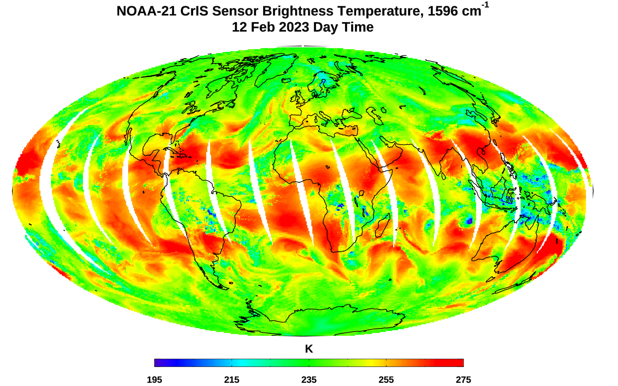
NOAA-21 CrIS First Light Image -
The CrIS sensor provides hyperspectral infrared observations over 2,211 channels with high radiometric and spectral accuracy. The first light image in brightness temperature was captured by the NOAA-21 CrIS sensor at the 1596 cm-1 water vapor channel on February 12, 2023. This image shows the large-scale waves of upper tropospheric water vapor and clouds over the Earth's globe.
Thanks and credit: STAR CrIS SDR Team. Click images to enlarge.
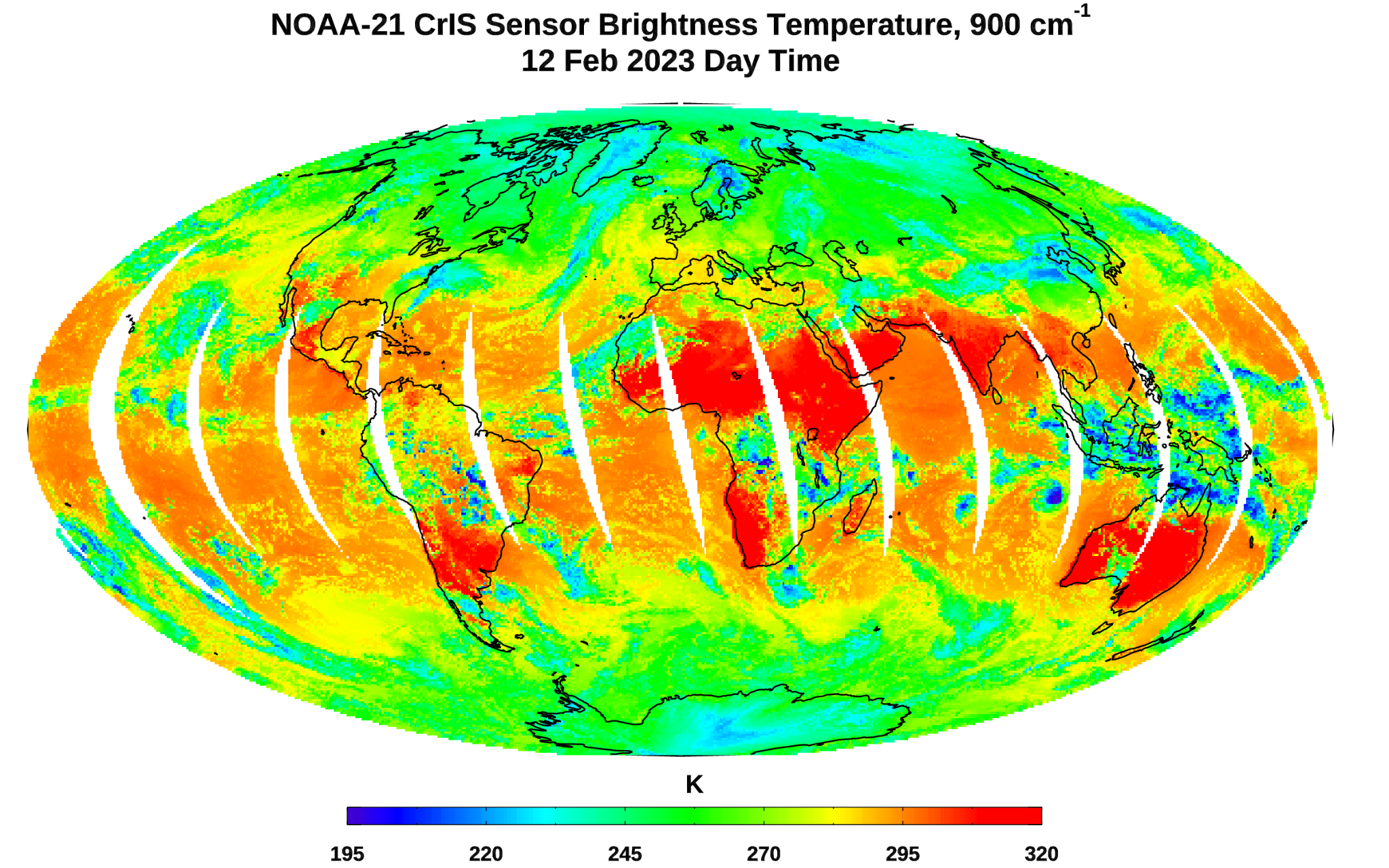
The CrIS sensor provides hyperspectral infrared observations over 2,211 channels with high radiometric and spectral accuracy. The first light image in brightness temperature captured by the NOAA-21 CrIS sensor at the 900 cm-1 window channel on February 12, 2023 is shown. Dark blue colors in the image are associated with cold cloud tops or cold surfaces. Red color regions are associated with light clouds or hot land surfaces.
Thanks and credit: STAR CrIS SDR Team. Click images to enlarge.
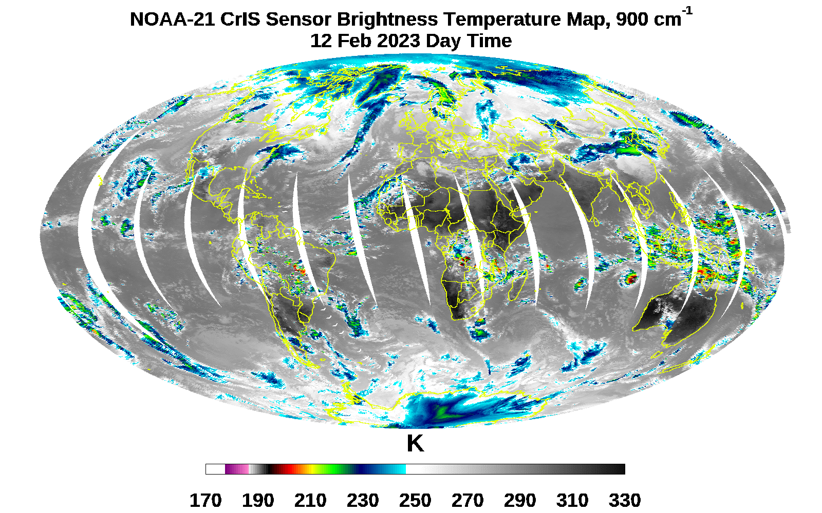
The CrIS sensor provides hyperspectral infrared observations over 2,211 channels with high radiometric and spectral accuracy. The first light image in brightness temperature was captured by the NOAA-21 CrIS sensor at the 900 cm-1 window channel on February 12, 2023. This image identifies different types of clouds at different vertical levels in the atmosphere.
Thanks and credit: STAR CRIS SDR Team. Click images to enlarge.

The STAR VIIRS SDR team has produced first light imagery from the VIIRS visible bands. The image shows true color imagery from December 5. The VIIRS visible/near infrared bands were the second instrument to be activated, with the VIIRS thermal bands, CRIS, and OMPS to follow in February.
Thanks and credit: STAR VIIRS SDR Team. Click images to enlarge.
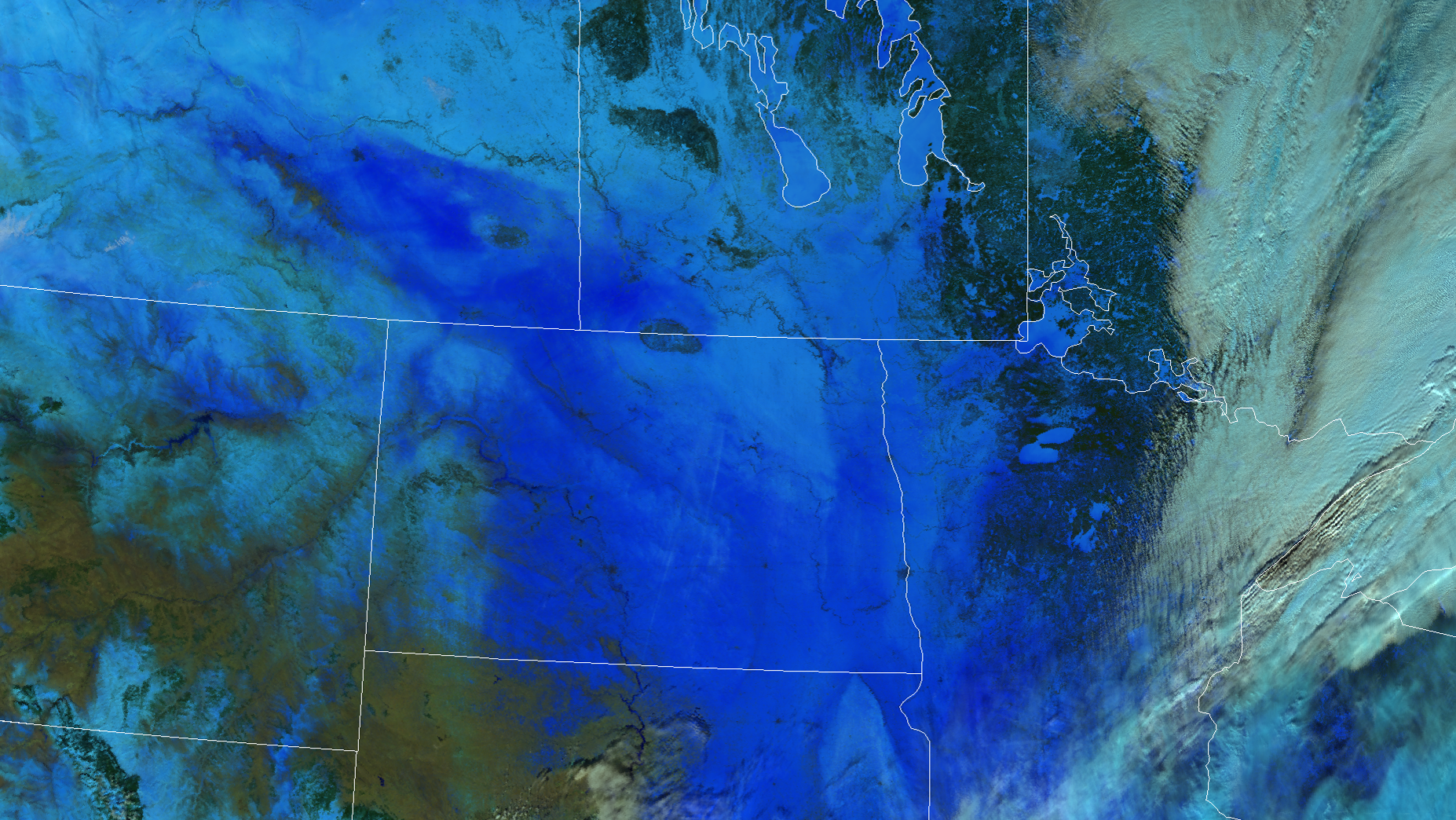
NOAA-21 VIIRS thermal emissive bands became active on February 9. The image above shows Snow Melt RGB imagery made with VIIRS bands M1-, M8, and M5. In this image, light blue areas are newer and drier snow, while darker blue areas are wetter and older snow.
Thanks and credit: STAR VIIRS Imagery Team. Click images to enlarge.
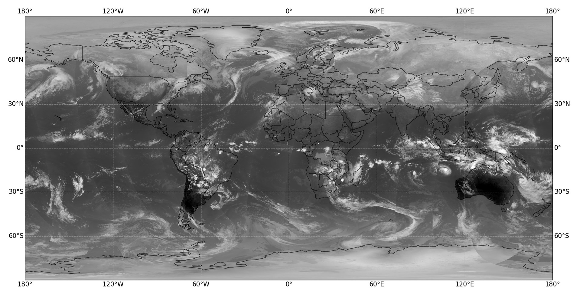
Grayscale imagery of VIIRS Band M15 from February 9. Band M15 is a thermal band is centered on 10.8 um and detects clouds and surface features including fire hotspots. Colder temperatues are lighter and warmer tmperatures closer to black. One can see the warmth of the land in the southern hemisphere where it is summer relative to the cold land and ice of the northern hemisphere winter.
Thanks and credit: STAR VIIRS SDR Team. Click images to enlarge.
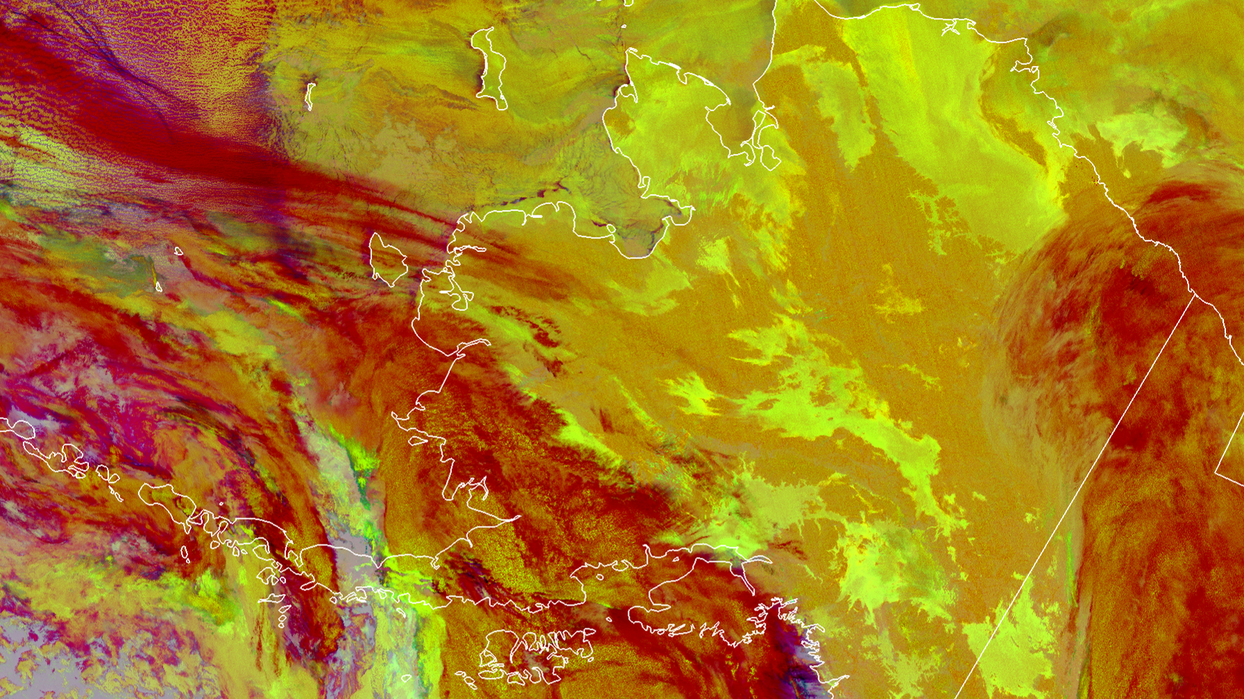
The NOAA-21 VIIRS Nighttime Cloud Microphysics RGB from February 9, 2023, shows various aspects of cloud structures. The maroon color represents high, thick cloud structures, while the darker yellow represents mid-level clouds.
Thanks and credit: STAR VIIRS Imagery Team. Click images to enlarge.
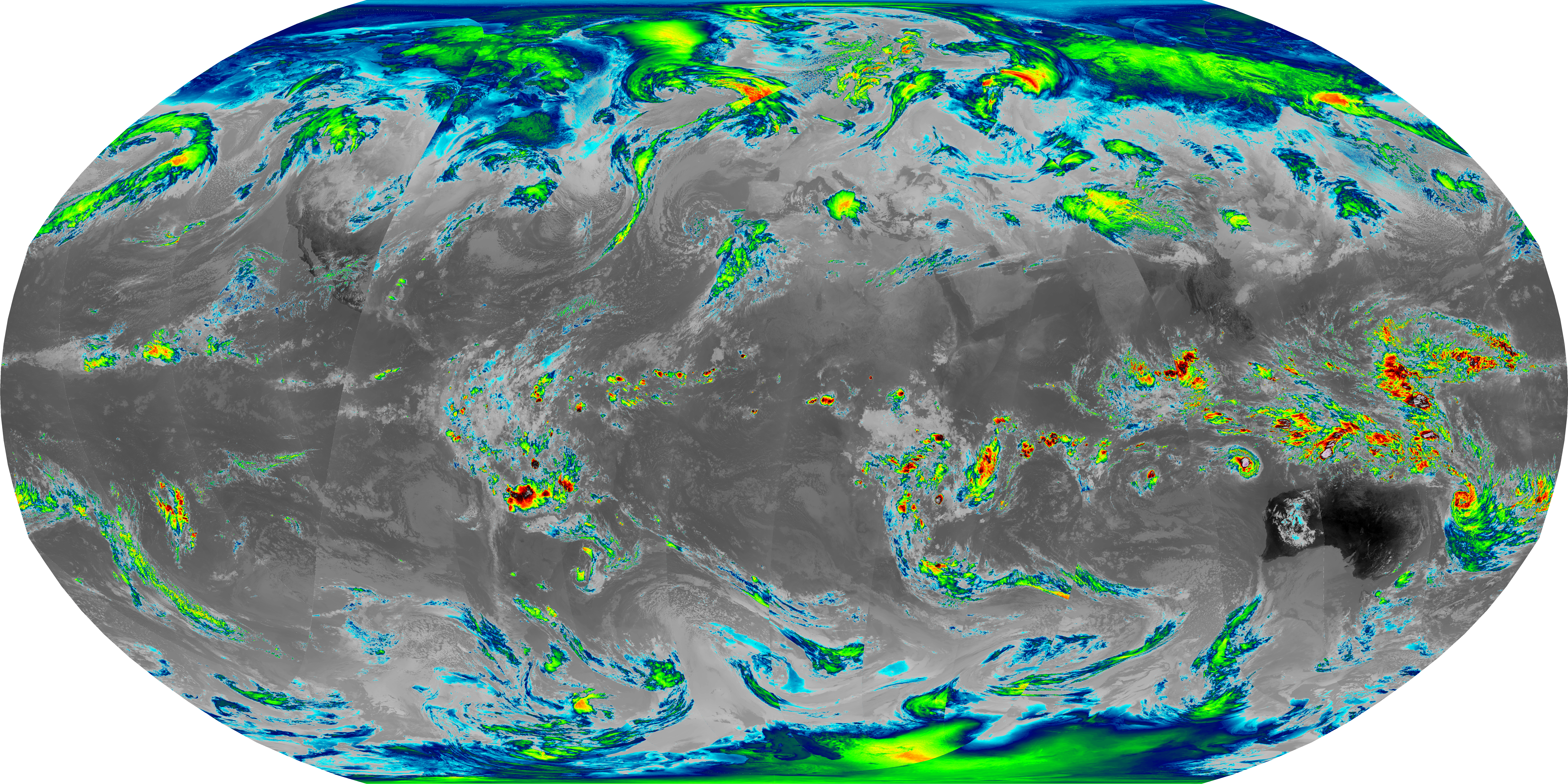
NOAA-21 VIIRS Band M15 (centered at 10.8 um) is seen in this global image. This traditional color scale is used to see storms systems including tropical cylcones. Cylcone Freddy, which eventually made landfall on Madagascar and Mozambique can be seen early in its formation off of the northwestern coast of Australia.
Thanks and credit: STAR VIIRS Imagery Team. Click images to enlarge.
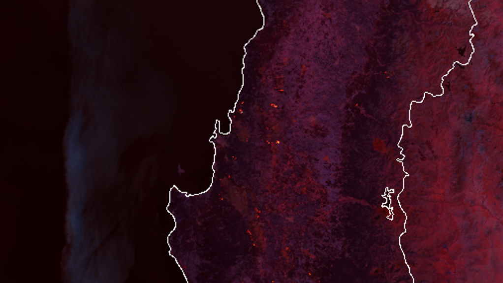
The NOAA-21 VIIRS Fire RGB product uses bands M10, M11, and M12 to detect and visualize fires. This image shows fire hotspots over Peru on February 9, 2023.
Thanks and credit: STAR VIIRS Imagery Team. Click images to enlarge.
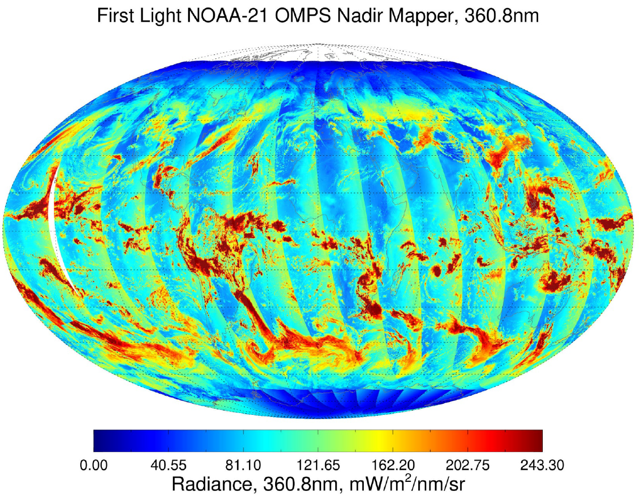
NOAA-21 OMPS NM First Light Image -
The Ozone Mapping Profiler Suite (OMPS) instrument on the NOAA-21 satellite
acquired its first data on February 18, 2023. This first-light image shows the radiance values for the cloud reflectivity
channel on the OMPS Nadir Mapper. The highest radiances are associated with
bright cloud tops. The cloud reflectivity channel is one of the five primary
channels used to estimate total ozone concentration. The striping pattern is
created from the slight differences in the angle of the satellite relative
to the incoming energy from the sun.
Thanks and credit: STAR OMPS SDR Team. Click images to enlarge.
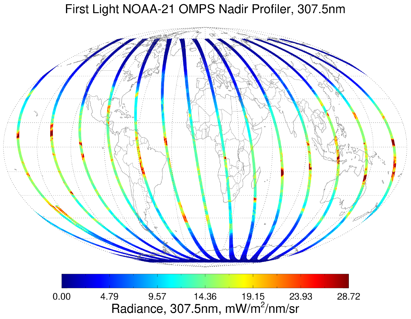
NOAA-21 OMPS NP First Light Image -
The Ozone Mapping Profiler Suite (OMPS) instrument on the NOAA-21 satellite
acquired its first data on February 18, 2023 This first-light image shows the radiance at 307.5 nm from the OMPS Nadir Profiler.
This measurement is one of the 12 primary channels used to estimate the ozone at
various levels in the atmosphere - closer to and farther from Earth's surface.
The OMPS Nadir Profiler only makes measurements directly under the satellite's path.
Thanks and credit: STAR OMPS SDR Team. Click images to enlarge.

An OMPS NM radiance retrieval over the Indian Ocean, showing Cyclone Freddy midway on its trek from Australia to Madagascar. The increased resolution of the NM on NOAA-21 compared to NOAA-20 and SNPP is readily evident.
Thanks and credit: STAR OMPS EDR Team. Click images to enlarge.
16 March 2023 -
The STAR JPSS SDR teams have released first light imagery for four of its advanced instruments - VIIRS, CRIS, ATMS, and OMPS, aboard NOAA-21. NOAA-21, which is the third satellite in the JPSS series, was launched on November 21, 2022. It will provide continuity for weather forecasters and the broader environmental monitoring community.
VIIRS produces stunning images of the Earth's surface, capturing the beauty and complexity of the planet's natural features in visible and infrared wavelengths. CrIS captures data on atmospheric temperature and moisture as well as the concentrations of various trace gasses important for human health and climate. ATMS collects data on the temperature and moisture of the atmosphere, which is essential for forecasting weather and tracking severe weather events. Finally, OMPS retrieves data on the ozone layer, providing valuable insights into the health of the planet's protective layer. In particular, OMPS features increased resolution
The release of this imagery marked a significant milestone for NOAA-21 and for the scientific community as a whole. The data collected by these instruments will be used to advance our understanding of the Earth's environment and inform policy decisions on issues such as climate change and natural resource management. With this groundbreaking technology at their fingertips, scientists and researchers around the world are poised to make new discoveries and advance our understanding of the world around us.
|

