STAR Satellite Rainfall Estimation
Self-Calibrating Multivariate Precipitation Retrieval (SCaMPR)
Ensemble Tropical Rainfall Potential (eTRaP)
Tropical cyclones are usually best known for strong winds, but they also produce heavy rainfall and inland flooding that frequently accounts for the majority of the damage-notable examples include Hurricane Agnes (1972), Hurricane Floyd (1999), Tropical Storm Allison (2001), and Tropical Storm Lee, which in 2011 broke many of the record flood crests set by Agnes.
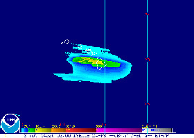
Tropical Rainfall Potential (TRaP; Kidder et al. 2005) is a 0-24 hour forecast of rainfall for a tropical system produced by extrapolating the current rainfall for a tropical system (derived using rain rates from microwave-frequency satellite-based sensors) along the official forecast storm track. TRaP became operational at NESDIS in 2003 and was followed by ensemble TRaP (eTRaP; Ebert et al. 2011), which is an ensemble of TRaPs for different satellite instruments, lead times, and forecast tracks. The ensemble provides information about forecast uncertainty, which is shown in the form of maps of the probability that the rainfall will exceed specific thresholds during the next 24 hours in 6-hour intervals. Real-eTRaP forecasts can be accessed from OSPO in real time at https://www.ssd.noaa.gov/PS/TROP/etrap.html.
References
Kidder, S. Q., S. J. Kusselson, J. A. Knaff, R. R. Ferraro, R. J. Kuligowski, and M. Turk, 2005: The Tropical Rainfall Potential (TRaP) technique, Part I: Description and examples. Wea. Forecasting, 20, 456- 464. DOI: 10.1175/WAF860.1
Ebert, E. E., M. Turk, S. J. Kusselson, J. Yang, M. Seybold, P. R. Keehn, and R. J. Kuligowski, 2011: Ensemble Tropical Rainfall Potential (eTRaP) forecasts. Wea. Forecasting, 26, 213-224. DOI: 10.1175/2010WAF2222443.1

