
STAR / SMCD / VIIRS Aerosol Calibration and Validation
SNPP/VIIRS (IDPS) Aerosol Products - Gridded Data
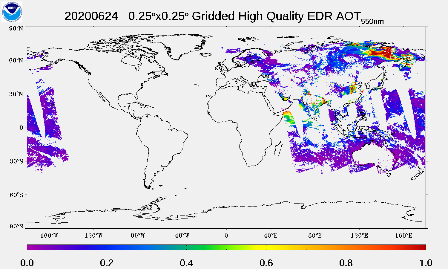
The operational VIIRS 550-nm AOT EDRs at nominal 6-km resolution, and collected during a 24-h period, are gridded on a regular 0.25 x 0.25-degree equal angle (~28x28 km at the equator) grid. The gridding process uses only high quality AOT EDRs.
The 0.25x0.25-degree gridded AOT for a given day can be displayed on the map below by selecting the year, month and day of interest, and by clicking the "Submit" button. Use the buttons "Day-1" and "Day+1" to step back and forward by one day, respectively. Use the "Latest" button to come back to the latest available day.
Daily files of gridded data can be downloaded from the STAR
IMPORTANT NOTES:
- The IDPS gridded AOT data is provided for the period May 2, 2021 - June 24, 2020.
-
The AOT
EDR data for the period of May 2, 2012 - January 22, 2013 are at Beta Maturity level, and those for the period of
January 23, 2013 - present are at Validated 2 Maturity level. - Gridded data for the period of October 15, 2012 - November 27, 2012 are not generated because, even though they exist, the AOT EDR data are not recommended for use for this period due to a processing error.
|
0.25x0.25-degree Gridded Aerosol Optical Thickness at 550 nm SNPP/VIIRS - IDPS Valid date range: 05/02/2012 - 06/24/2020 |
||||
|
AOT EDR Gridding Processes
Each EDR pixel is associated with geolocation data (LAT, LON) that describes the center of the pixel. For each grid box (i,j), if (LAT, LON) falls within the boundary of a grid box then this AOT EDR is counted toward the Mean AOT computation of that grid box (i,j). The grid-box value of the AOT is the arithmetic average of all AOT EDRs falling into the grid box. More information is in the ReadMe file.
(Hover over the acronyms to see their definition.)