
STAR / SMCD / VIIRS Aerosol Calibration and Validation
VIIRS to MODIS Formatting Tool
Overview
The VIIRS to MODIS-like formatting tool is a set of command line tools written in the Interactive Data Language (IDL) that converts VIIRS Aerosol files with matching Geolocation data into a HDF-EOS format similar to the MODIS Level 2 Aerosol product.
Download
Current version is 2.2, released 09/16/2015.
- IDL source codes, (ZIP, 9 KB, 9/16/2015)
- Sample input and output file, (ZIP, 138.7 MB, 9/16/2015)
Version History
Version 1.0: Released 09/09/2014.
- Initial release
Version 2.0: Released 01/20/2015.
- Added ability to convert individual EDR granules
- New tool added to convert VIIRS IP Aerosol
Version 2.1: Released 02/21/2015.
- Revised method of setting SDS attributes
Version 2.2: Released 09/16/2015.
- Small bug fix to ensure data and fill value types match in EDR output
Requirements
IDL 8.1 or above is required to run this tool. A valid IDL license is required to compile and run the source code.
Installation
Place the source files into a directory of your choice.
Tool Execution
NOTE: In order for this tool to run, the user must provide the VIIRS granules along with the matching geolocation file. The IP AOT (product IDL: 'IVAOT') uses the same Terrain Corrected Geolocation (product ID: 'GMTCO') as VIIRS SDR's while the Aerosol EDR (product ID: 'VAOOO') uses its own Aerosol Geolocation file (product ID: 'GAERO'). In order to match up an AOT file with the correct geolocation file one must make sure that the date, start/end times, and orbit number are identical. For more details regarding the matching of AOT and geolocation files, please consult the Aerosol Products User's Guide.
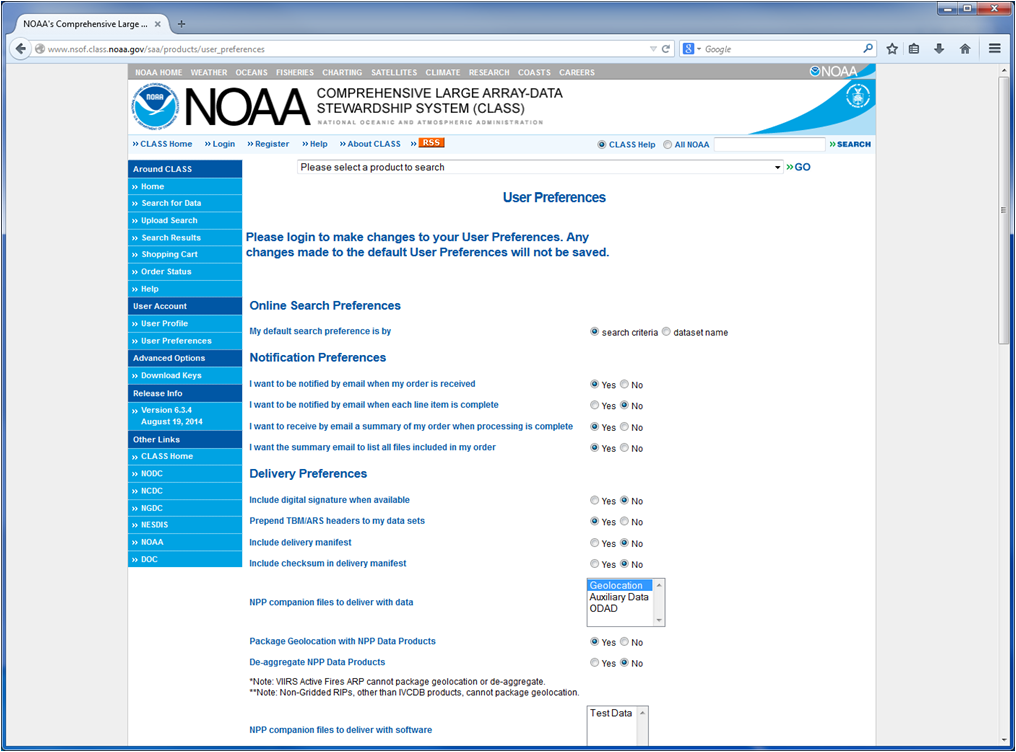
In addition, the EDR tool can convert aggregated EDR files packaged with geolocation available through NOAA-CLASS. To obtain aggregated files one must make sure that their User Preferences are correctly set prior to ordering data. To do this, first navigate to your user preferences after logging into CLASS. Under the �Delivery Preferences� heading, make sure that Geolocation is selected in the menu to the right of �NPP companion files to deliver with data�. In addition, check to make sure that the option to package geolocation data immediately below this is set to �Yes and the option to de-aggregate NPP data products is set to �No� (see screenshot).
Aerosol files correctly packaged with geolocation data will begin with the Data Product ID "GAERO-VAOOO".
Converting VIIRS IP Aerosol files:
- Start IDL
- Navigate to the directory where you have placed the source code for the conversion tool.
- Compile the code by typing .compile viirs_ip_convert at the IDL prompt.
- If the data to be converted is in the same directory as the source code, then the tool can be run by typing viirs_ip_convert at the prompt.
- If the data is not located in the same directory as the source code, you must provide the data path when calling the procedure using the following syntax: viirs_ip_convert, <data_path> where <data_path> is the location of the data files surrounded in quotes.
Converting VIIRS EDR Aerosol files:
- Start IDL
- Navigate to the directory where you have placed the source code for the conversion tool.
- Compile the code by typing .compile viirs_edr_convert at the IDL prompt.
- If the data to be converted is in the same directory as the source code, then the tool can be run by typing viirs_edr_convert at the prompt.
- If the data is not located in the same directory as the source code, you must provide the data path when calling the procedure using the following syntax: viirs_edr_convert, <data_path> where <data_path> is the location of the data files surrounded in quotes.
Contact
Direct any questions or bugs to the author, Ivan Valerio.