Ocean Topography and Cryosphere Branch / Laboratory for Satellite Altimetry / Sea Level Rise
Project background
According to the IPCC Fourth Assessment Report (FAR), global mean sea level may increase by 0.5 m over the next 50 to 100 years, and more if significant accelerations occur in the next couple of decades. There is already evidence of a recent acceleration. Current satellite altimeter observations show sea level rising at ~3 mm/yr, nearly twice as fast as the tide gauge measured rate over the past 100 years.
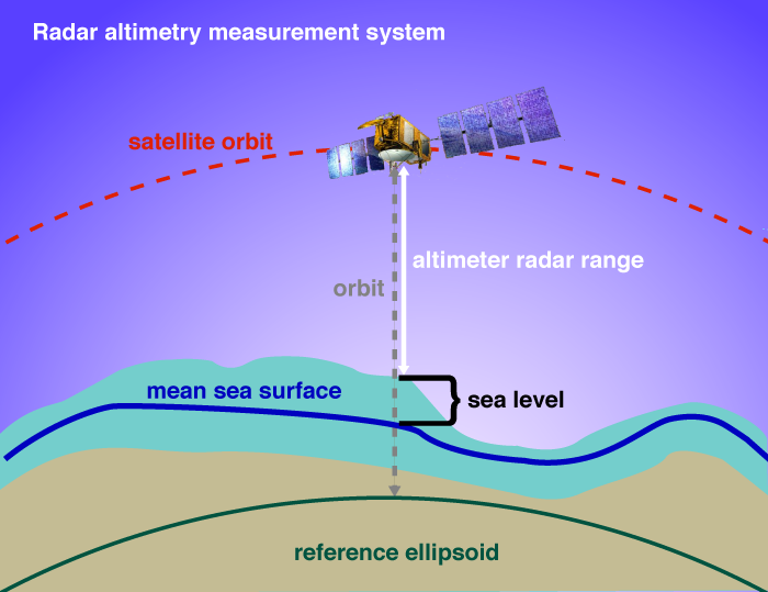
CLS has created a tutorial on satellite radar altimetry is available at www.altimetry.info.