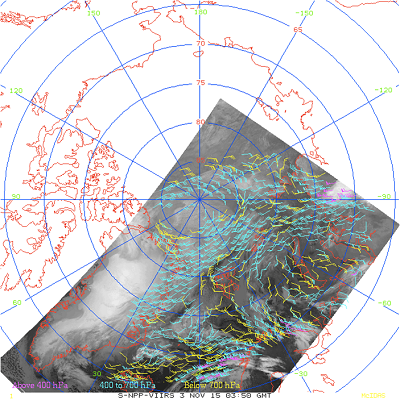
VIIRS Polar Winds
Team Lead: Jaime Daniels
Product Description
VIIRS Polar Winds are derived by tracking clouds features in the VIIRS longwave infrared channel (Band M15, 10.8µm)
- Wind speed, direction, and height are measured throughout the troposphere, poleward of approximately 65 degrees latitude, in cloudy areas only
- Wind information is generated in both the Arctic and Antarctic regions
- The product includes observation time, data quality flags, and metadata
- The VIIRS Polar Winds product has been operational since May 2014
- VPW is also generated at direct broadcast sites and delivered to NWP centers
Product and Data Access
Wind information is generated in both the Arctic (NH) and Antarctic (SH) regions for
- High-Level: 100-400 mb
- Mid-Level: 400-700 mb
- Low-Level: > 700 mb
Users
NCEP, NRL/FNMOC, GMAO/JCSDA, UK Met Office, JMA, ECMWF, DWD, Meteo-France, CMC, BOM, EUMETSAT, Russian Hydrometcenter, CMA
Planned further improvements
- The Enterprise cloud mask will be used
- Spatial coverage will be increased by about 5° latitude

