Land Surface Temperature (LST)
Team Lead: Ivan Csiszar
Background
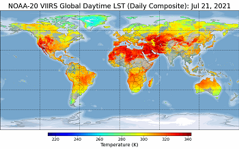
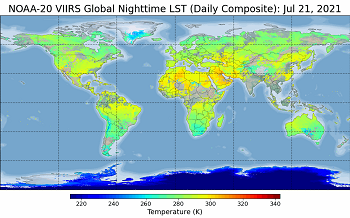
Land surface temperature, a key indicator of the Earth surface energy budget, is widely required in applications of hydrology, meteorology, and climatology. It is of fundamental importance to the net radiation budget at the Earth surface and to monitoring the state of crops and vegetation, as well as an important indicator of both the greenhouse effect and the energy flux between the atmosphere and ground (Norman & Becker, 1995; Li & Becker, 1993). The VIIRS LST product, one of the baseline land Environmental Data Records (EDR) for the JPSS mission, is composed of Level 2 (L2) granule LST and Level 3 (L3) gridded LST. The L2 VIIRS LST product was initially generated based on the surface type dependent LST algorithm (Yu et al., 2005) which was then replaced by the emissivity explicit LST algorithm, i.e. enterprise algorithm. The enterprise L2 VIIRS LST reached the provisional and the validated V1 maturity status in February 2019 and November 2019, respectively. The L3 global gridded VIIRS LST was put into operation in May 2020.
Algorithm Science and Data Access
The LST EDR is the measurement of the skin temperature over global land coverage including coastal and inland water. Currently, The VIIRS LST EDR is derived from a baseline split-window regression algorithm (Liu et al., 2019):

Products and data:
EDR Long Term-Monitoring
Documentation
- LST ATBD, (PDF, 6.19 MB)
- LSE ATBD, (PDF, 1.51 MB)
- L3 LST&LSA ATBD, (PDF, 3.36 MB)
Where C and A1-A5 are algorithm coefficients, which are stratified
by day/night condition, total column water vapor and satellite viewing angles.
T11 and T12 represent the top-of-atmosphere brightness temperatures
at ~11 µm and 12 µm, respectively; ε = (ε11 +
ε12)/2 and Δε = (ε11 - ε12),
where ε11 and ε12 are the spectral emissivity values of
the land surface at ~11 µm and 12 µm channels, respectively.
The two VIIRS thermal infrared spectral bands being used for this split window algorithm
are the M15 band (centered at 10.76 µm) and the M16 band (centered at 12.01 µm).
The emissivity product was developed to support the LST retrieval which provides the spectral emissivity for
split window channels and the broadband emissivity for the spectral domain between 8-14 µm (Wang et al., 2019).
The official JPSS LST EDR product can be accessed from CLASS. The step by step instruction provides more details on how to use CLASS to search and order data.
Users
In the US, demands of satellite LST data including the VIIRS LST EDR are from a variety of government agencies including the NOAA, Department of Agriculture (USDA), Environmental Protection Agency (EPA), Department of the Interior (DOI), Department of Defense (DOD), as well as from universities and research institutes worldwide.
Calibration and Validation
Two approaches of satellite LST product validation techniques are adapted to validate the VIIRS LST product: temperature based method (T-based) and the radiance based (R-based) methods [Wan and Li, 2008]. The T-based method is a direct comparison analysis of ground in-situ LST observations and the satellite derived LSTs, which is based on the assumption that the ground in-situ LST estimates are good reference of the satellite LSTs at pixel level. Currently we utilized the in-situ LSTs from the U.S. SURFace RADiation budget observing network (SURFRAD), Baseline Surface Radiation Network (BSRN) and Atmospheric Radiation Measurement (ARM) [Sun et al., 2003; Yu et al., 2009; Liu et al., 2015; Liu et al., 2019; Wang and Liang, 2009]. In the R-based validation, we utilized a radiative transfer simulation tool (i.e. MODTRAN) for the reference LST estimation using NCEP atmospheric profiles for the atmospheric correction computation. The JPSS mission requirement for LST is 1.4 K in accuracy and 2.5 K in precision. The VIIRS LST product meets the mission requirement based on the validation.
Ongoing Improvements
Although the VIIRS LST EDR has passed criteria of the validated V1 release, the team is still working hard on some critical improvements. First, a comprehensive validation effort is ongoing for global of geographic regions. The team is also in collecting of high accurate atmospheric profiles for accurate R- based validation. Second, the team has been committed to promote LST applications e.g. model applications, heatwave and drought monitoring etc. In addition, the long-term validation tool is in continuous improvements for monitoring performance of the VIIRS LST production.
References
Li, Z.-L., & Becker, F. (1993). Feasibility of land surface temperature and emissivity determination from AVHRR data. Remote Sensing of Environment, 43, 67-85.
Liu, Y.; Yu, Y.; Yu, P.; Göttsche, F.M.; Trigo, I.F. (2015), Quality Assessment of S-NPP VIIRS Land Surface Temperature Product. Remote Sens., 7, 12215-12241.
Liu, Y.; Yu, Y.; Yu, P.; Wang, H.; Rao, Y. (2019). Enterprise LST Algorithm Development and Its Evaluation with NOAA 20 Data. Remote Sens.11 (17), 2003.
Norman, J. M., & Becker, F. (1995). Terminology in thermal infrared remote sensing of natural surfaces. Agricultural and Forest Meteorology, 77, 153-166.
Sun, D., & Pinker, R. T. (2003). Estimation of land surface temperature from a Geostationary Operational Environmental Satellite (GOES-8). Journal of Geophysical Research, 108, 4326.
Wan, Z., & Li, Z.-L. (2008). Radiance-based validation of the V5 MODIS land-surface temperature product. International Journal of Remote Sensing, 29, 5373-5395.
Wang, H., Yu, Y., Yu, P., & Liu, Y. (2019). Land Surface Emissivity Product for NOAA JPSS and GOES-R Missions: Methodology and Evaluation. IEEE Transactions on Geoscience and Remote Sensing, 58(1), 307-318.
Wang, K., & Liang, S. (2009). Evaluation of ASTER and MODIS land surface temperature and emissivity products using long-term surface longwave radiation observations at SURFRAD sites. Remote Sensing of Environment, 113, 1556-1565.
Yu, Y., Tarpley, D., Privette, J. L., Goldberg, M. D., Rama Varma Raja, M. K., Vinnikov, K. Y.,et al. (2009). Developing algorithm for operational GOES-R land surface temperature product. IEEE Transactions on Geoscience and Remote Sensing, 47, 936-951.
Yu, Y., Privette, J. L. and Pinheiro, A. C. (2005). Analysis of the NPOESS VIIRS land surface temperature algorithm using MODIS data, IEEE Trans. Geosci. Remote Sens., 43(10), 2340-2350.


