Laboratory for Satellite Altimetry / Sea Ice and Polar Dynamics Science Team
Current and Future Satellite Missions
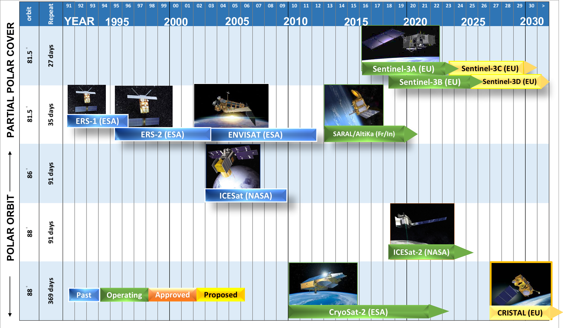
Since the early 1990s, satellite altimeters have transformed our ability to map mass changes in the polar ice cover over decadal time-scales. On April 8, 2010 the European Space Agency (ESA) successfully launched the CryoSat-2 radar altimeter satellite, which continues to operate. In September 2018 NASA launched ICESat-2, a follow-up mission to ICESat (2003-2009), extending the dedicated polar altimeter time series. In anticipation of a potential data gap at the conclusion of the ICESat-2 mission, under the Copernicus Expansion Program, ESA has proposed the Copernicus polaR Ice and Snow Topography ALtimeter (CRISTAL) mission, which will carry a dual-band radar altimeter.
We support the validation of CryoSat-2 and ICESat-2 sea ice elevation measurements through the collection of independent ground-truth and airborne field data. We participated as collaborators in the NASA IceBridge Airborne Mission between 2009 and 2019.

