Glossary
ABI
The Advanced Baseline Imager (ABI) is the primary instrument on the GOES-R Series satellites for imaging Earth’s weather, oceans and environment. It is an imaging radiometer with 16 spectral bands: 2 visible bands, 4 near-infrared bands, and 10 infrared bands. It provides 3 times more spectral information, 4 times the spatial resolution, and more than 5 times faster temporal resolution than the legacy GOES imager.
Aerosol Detection Product (ADP)
The Aerosol Detection Product (ADP), also called the smoke/dust mask, is a qualitative indicator of smoke and dust in the atmosphere. Pixels with smoke or dust aerosols are identified from spectral and spatial threshold tests using visible and infra-red bands of the VIIRS or ABI sensors.
Aerosol Optical Depth (AOD)
Aerosol Optical Depth (AOD) is a quantitative measure of the amount of aerosols in the atmosphere. AOD is a measure of the extinction (scattering and absorption) of radiation by aerosols. It depends on the wavelength of radiation; VIIRS and ABI AOD are reported for 550 nm.
Algorithm
An algorithm is a step-by-step procedure or formula used to obtain a specific result.
Band
Spectral bands (also called channels) are the wavelength ranges of the electromagnetic spectrum which are measured by a satellite sensor. For example, VIIRS has 22 spectral bands and ABI has 16 spectral bands.
Beta Maturity
Beta maturity satellite products are early-release, preliminary, non-operational products that have been minimally validated and may still contain significant errors.
Data Quality Flags
Data Quality Flags express the high, medium, or low confidence in the retrieval of NOAA aerosol satellite products. Data Quality Flags are available for AOD and ADP retrieved from VIIRS and ABI.
Recommended Data Quality Flags:
- AOD
- For quantitative applications, use High Quality AOD only
- For qualitative applications, use Top 2 Qualities AOD (High + Medium)
- ADP
- For quantitative applications, use Top 2 Qualities ADP (High + Medium)
- For qualitative applications, use All Qualities ADP (High + Medium + Low)
Dust Mask
See Aerosol Detection Product (ADP).
Enterprise Processing System (EPS)
NOAA Enterprise Processing System (EPS) algorithms use the same method (physics and assumptions) and its realization (software) to retrieve the same satellite product (e.g., AOD) from different sensors, each sensor having different bands, spatial resolution, pixel size, geographical coverage, and temporal resolution. So instead of having slightly different algorithms for each individual sensor, EPS algorithms are designed to be sensor agnostic. For example, EPS aerosol algorithms are designed to be used for both VIIRS and ABI.
Fire Radiative Power (FRP)
Fire Radiative Power (FRP) is a quantitative measure of fire intensity. It is available from VIIRS and ABI.
Full Maturity
Full maturity (also called Validated maturity) satellite products are fully operational and have been tested and documented over a wide range of conditions.
GEO
Geostationary orbit. See Geostationary Satellites.
GeoColor
ABI does not have a green band, so it is not possible to create true color (RGB) imagery for ABI. GeoColor imagery utilizes a simulated green band in conjunction with ABI’s blue and red bands to approximate RGB imagery during daytime. At night, GeoColor imagery is an IR-based multispectral product that differentiates between low liquid water clouds and higher ice clouds, overlaid on a static city lights database (derived from the VIIRS Day-Night band) to aid geo-referencing.
Geostationary Satellites
Geostationary satellites, also called geosynchronous satellites, are in a high-altitude orbit (~36,000 km). At this altitude, the orbital period of the satellite matches the rotational speed of the Earth. As a result, a geostationary satellite continuously observes the same area (hemisphere) of the Earth’s surface. Geostationary satellites are typically used to monitor meteorological conditions and severe storm development. Examples: GOES-19 and GOES-18.
GOES
NOAA’s Geostationary Operational Environmental Satellites (GOES) are U.S. national geostationary satellites that provide continuous information on weather conditions and severe storm development. GOES-East is centered at 75.2 °W longitude and GOES-West is centered at 137.0 °W longitude.
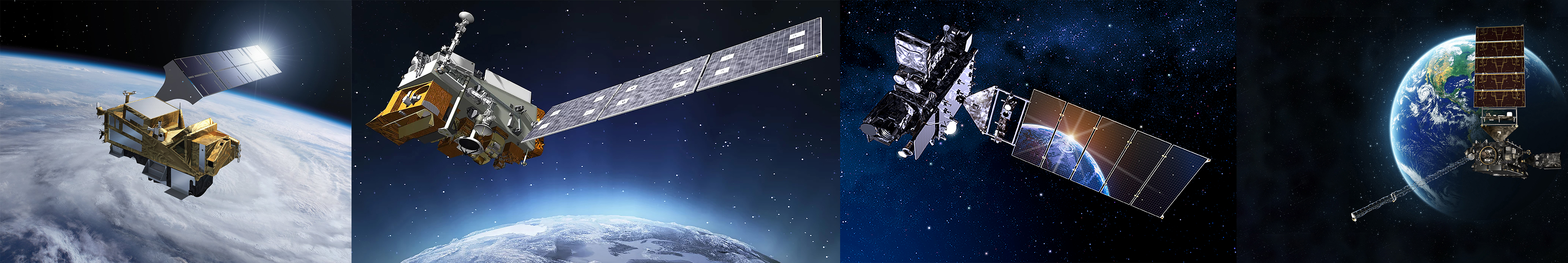
GOES-16 (GOES-R before launch)
Geostationary Operational Environmental Satellite (GOES)-16 is the first in the GOES-R series. GOES-16 launched on November 19, 2016 and was operational as GOES-East December 11, 2017 through April 7, 2025. It carries six instruments, including ABI.
GOES-17 (GOES-S before launch)
Geostationary Operational Environmental Satellite (GOES)-17 is the second in the GOES-R series. GOES-17 launched on March 1, 2018 and was operational as GOES-West November 13, 2018 through January 3, 2023. It carries six instruments, including ABI.
GOES-18 (GOES-T before launch)
Geostationary Operational Environmental Satellite (GOES)-18 is the third in the GOES-R series. GOES-18 launched on March 1, 2022 and replaced GOES-17 as GOES-West on January 4, 2023. It carries six instruments, including ABI.
GOES-19 (GOES-U before launch)
Geostationary Operational Environmental Satellite (GOES)-19 is the fourth and final satellite in the GOES-R series. GOES-19 launched on June 25, 2024 and replaced GOES-16 as GOES-East on April 7, 2025. It carries six instruments, including ABI.
GOES-East
GOES-East is the Geostationary Operational Environmental Satellite (GOES) centered at 75.2 °W longitude. GOES-19 is currently GOES-East.
GOES Imager Projection (ABI Fixed Grid)
The GOES Imager Projection, also called the ABI Fixed Grid, is the projection information included in all ABI Level 1b data files and most ABI Level 2 data files, to save file space. It is a map projection based on the geostationary viewing perspective of the GOES-East or GOES-West satellite.
GOES-R Series
The Geostationary Operational Environmental Satellite (GOES) – R Series is NOAA’s latest generation of geostationary satellites. The GOES-R Series is a four-satellite program (GOES-R/S/T/U) that extends the availability of the operational GOES satellite system through 2036.
GOES-West
GOES-West is the Geostationary Operational Environmental Satellite (GOES) centered at 137.0 °W longitude. GOES-18 is currently GOES-West.
Granule
VIIRS Level 2 (L2) data are distributed as granules. A VIIRS granule consists of 48 scans, taking about 85 seconds to complete and covering approximately 3040 km x 570 km.
JPSS Series
The Joint Polar Satellite System (JPSS) Series is the new generation of polar-orbiting operational environmental satellites for the U.S. JPSS is a collaborative program between NOAA and NASA. The JPSS Series satellites circle the Earth from pole-to-pole and cross the equator about 14 times daily in an ascending early afternoon orbit, providing full global coverage twice a day (once during the day, and once at night).
LEO
Low-Earth orbit. See Polar-Orbiting Satellites.
Level 1b (L1b) Data
Level 1b (L1b) satellite data are radiances measured by a sensor that have been calibrated and geo-located.
Level 2 (L2) Data
Level 2 (L2) satellite data are geophysical parameters (e.g., AOD) that have been derived from Level 1b data via scientific algorithms.
Level 3 (L3) Data
Level 3 (L3) satellite data are Level 2 data that have been mapped on a uniform space-time grid, and thus have been averaged over space and/or time.
Nadir
The nadir of a satellite is the point on the Earth’s surface directly below the satellite. A satellite sensor has its maximum spatial resolution at nadir.
NOAA-20 (JPSS-1 or J01 before launch)
The NOAA-20 satellite is the second in the JPSS Series. NOAA-20 launched on November 18, 2017 and carries five instruments, including VIIRS. It is a polar-orbiting satellite in an ascending orbit with an equatorial crossing time of 1:30 pm (50 minutes offset with SNPP).
NOAA-21 (JPSS-2 or J02 before launch)
The NOAA-21 satellite is the third in the JPSS Series. NOAA-21 launched on November 10, 2022 and carries four instruments, including VIIRS. It is a polar-orbiting satellite in an ascending orbit with an equatorial crossing time of 1:30 pm.
NODD
The NOAA Open Data Dissemination (NODD) Program provides access to NOAA data on commercial cloud platforms, including Amazon Web Services (AWS), Google Earth Engine, and Microsoft Azure, through public-private partnerships. The goal of the NODD Program is to make it easy for the public and end users to access NOAA data.
Operational Satellite Data
Operational satellite data are generated and made available to end users via a fast latency process, typically 15 minutes to 3 hours after satellite overpass.
Pixel
A pixel is an abbreviation for a picture element. Satellite remote sensing measurements are composed of a matrix of pixels, which are the smallest units of the measurement. Pixels are typically square or rectangular and usually correspond to the spatial resolution of the instrument that made the measurement.
Polar-Orbiting Satellites
Polar-orbiting satellites, also called low-Earth orbiting (LEO) satellites and sun-synchronous satellites, are in a low altitude orbit (~700-800 km) around the North and South Poles. The Earth rotates under a polar-orbiting satellite, so each time the satellite completes an orbit, it observes a different area of the Earth. Polar-orbiting satellites are used for a variety of applications, including air quality, land cover, water quality, and vegetation studies. Examples: SNPP, NOAA-20, S5P.
Provisional Maturity
Provisional maturity satellite products are ready for operational use, although incremental product improvements may still be occurring, and validation is ongoing; product performance had been demonstrated through a limited range of conditions.
Reprocessed Satellite Data
Reprocessed satellite data are generated by running the full or partial time series of available Level 1b data through the most recent version of a Level 2 algorithm, to create the most accurate and consistent Level 2 dataset suitable for long-term data analysis.
Scan
ABI and VIIRS make measurements by moving (scanning) “back and forth” (west to east or east to west) as they move over the Earth’s surface along their orbits. One complete VIIRS scan is approximately 3040 km x 12 km in area and takes about 1.75 seconds to complete. ABI scan areas and duration vary depending on the scan mode and scan sector.
Scan Mode (ABI)
The ABI scan modes are the timelines for observing (scanning) the ABI full disk, CONUS/PACUS, and mesoscale scan sectors.
Scan Sector (ABI)
The ABI scan sectors are the geographic regions observed (scanned) by ABI: full disk (hemisphere), CONUS/PACUS (3000 km x 5000 km), and mesoscale (1000 km x 1000 km).
Sentinel 5-Precursor (S5P)
The Copernicus Sentinel-5 Precursor (S5P) satellite is a collaboration between the European Space Agency (ESA), the European Commission, the Netherlands Space Office, industry, data users and scientists. S5P was launched on October 13, 2017 and carries one sensor, the TROPOspheric Monitoring Instrument (TROPOMI). It is a polar-orbiting satellite in an ascending orbit with an equatorial crossing time of 1:30 pm (~3 minutes behind SNPP).
Smoke Mask
See Aerosol Detection Product (ADP).
SNPP (NPP before launch)
The Suomi-National Polar-orbiting Partnership (SNPP) satellite is the first in the JPSS Series. SNPP launched on October 28, 2011 and carries five instruments, including VIIRS. It is a polar-orbiting satellite in an ascending orbit with an equatorial crossing time of 1:30 pm (50 minutes offset with NOAA-20).
Spatial Resolution
The spatial resolution of a satellite sensor is the smallest area the sensor can observe. It is typically given as a distance and corresponds to the pixel size at nadir. For example, if a sensor has a spatial resolution of 1 km, and an image from that sensor is displayed at full resolution, a pixel at nadir represents an area of 1 km × 1 km on the ground. In general, spatial resolution is highest at nadir.
Spectral Resolution
Spectral resolution refers to the range of wavelengths measured by a satellite sensor. The narrower the wavelength range of a sensor’s spectral bands, the higher the spectral resolution. A sensor with many narrow bands has high spectral resolution, while a sensor with fewer, broader bands has low spectral resolution. The higher the spectral resolution of a sensor, the more specific types of observations it can make.
Sunglint
Sunglint is an optical phenomenon that occurs when sunlight reflects off the surface of water (oceans, lakes, and rivers) at the same angle that the water is being viewed by a satellite sensor. The water reflects sunlight back to the sensor and causes measurement artifacts. ABI and VIIRS AOD are not retrieved over sunglint regions. ABI and VIIRS ADP are retrieved over sunglint regions, but only smoke detection should be used (dust detection is not recommended). In VIIRS true color or ABI GeoColor imagery, sunglint regions look like a mirror, with a hazy silver or bronze appearance.
Swath
The swath is the area of the Earth’s surface that a polar-orbiting satellite sensor observes during one orbit.
Swath Width
The swath width is the east/west distance of a swath. The swath width of VIIRS is approximately 3040 km; this relatively wide swath prevents gaps in coverage over the Earth’s equatorial regions.
TEMPO
The Tropospheric Emissions: Monitoring of Pollution (TEMPO) sensor is a grating spectrometer with a spectral range of 290–740 nm (UV to VIS). TEMPO is the first air quality and atmospheric composition instrument to fly on a geostationary satellite (Intelsat 40e) over the Western Hemisphere. TEMPO makes hourly observations of North America from Mexico City to the Canadian oil sands, and from the Atlantic Ocean to the Pacific Ocean, at relatively high spatial resolution.
Temporal Resolution
The temporal resolution of a satellite sensor is how frequently it observes the same area. Temporal resolution is tied to the satellite’s orbit. Geostationary satellites have high temporal resolution, on the order of minutes, because they continuously observe the same area of the Earth. Polar-orbiting satellites have relatively low temporal resolution, on the order of one or more days, because they observe a new area of the Earth with each orbital pass.
TROPOMI
The TROPOspheric Monitoring Instrument (TROPOMI) is the only sensor on the S5P satellite. TROPOMI is a passive grating imaging spectrometer with a push broom staring (non-scanning) in nadir viewing configuration. It has 4 spectrometers, each electronically split in two bands (2 ultra-violet, 2 visible, 2 near-infrared, 2 shortwave-infrared). TROPOMI makes atmospheric measurements with relatively high spatial resolution for air quality, radiation, and climate applications.
True Color (RGB) Imagery
True color imagery, abbreviated RGB for red-green-blue, is made from combining the measurements from the red, green, and blue spectral bands of a satellite sensor. True color imagery looks like a photograph. Clouds are bright white, oceans and lakes are blue, forests and farmland are green, and deserts and mountains are brown.
Validated Maturity
Validated maturity (also called Full maturity) satellite products are fully operational and have been tested and documented over a wide range of conditions.
VIIRS
The Visible Infrared Imaging Radiometer Suite (VIIRS) is an instrument on the JPSS Series satellites. It is a scanning radiometer with 22 spectral bands ranging from 412 nm to 12 µm. VIIRS collects high spatial resolution visible and infrared imagery and radiometric measurements of the Earth’s land, atmosphere, cryosphere, and oceans.