VIIRS Granules
What are VIIRS Granules?
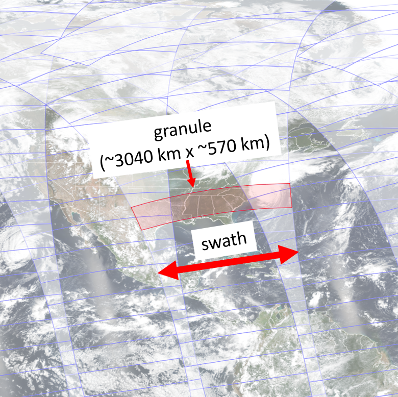
To keep data file sizes manageable for end users, VIIRS Level 2 (L2) data are distributed as granules. The figure below shows an example of a VIIRS swath, the area of the Earth’s surface that VIIRS observes during one orbit, divided into granules (click image to open full size version). The VIIRS sensor scans across its swath as it orbits around the North and South Poles. One VIIRS scan is approximately 3040 km x 12 km in area. A VIIRS granule consists of 48 scans, taking about 85 seconds to complete and covering approximately 3040 km x 570 km.
How to Find Individual VIIRS Granules
For a given date and satellite, VIIRS granules are classified by the observation start and end times. Knowing these times is very helpful when downloading VIIRS L2 data files. If you know the approximate start and end times for the granules that cover your area of interest, you can use that information to narrow your file search via the JPSS NODD on AWS or in CLASS.
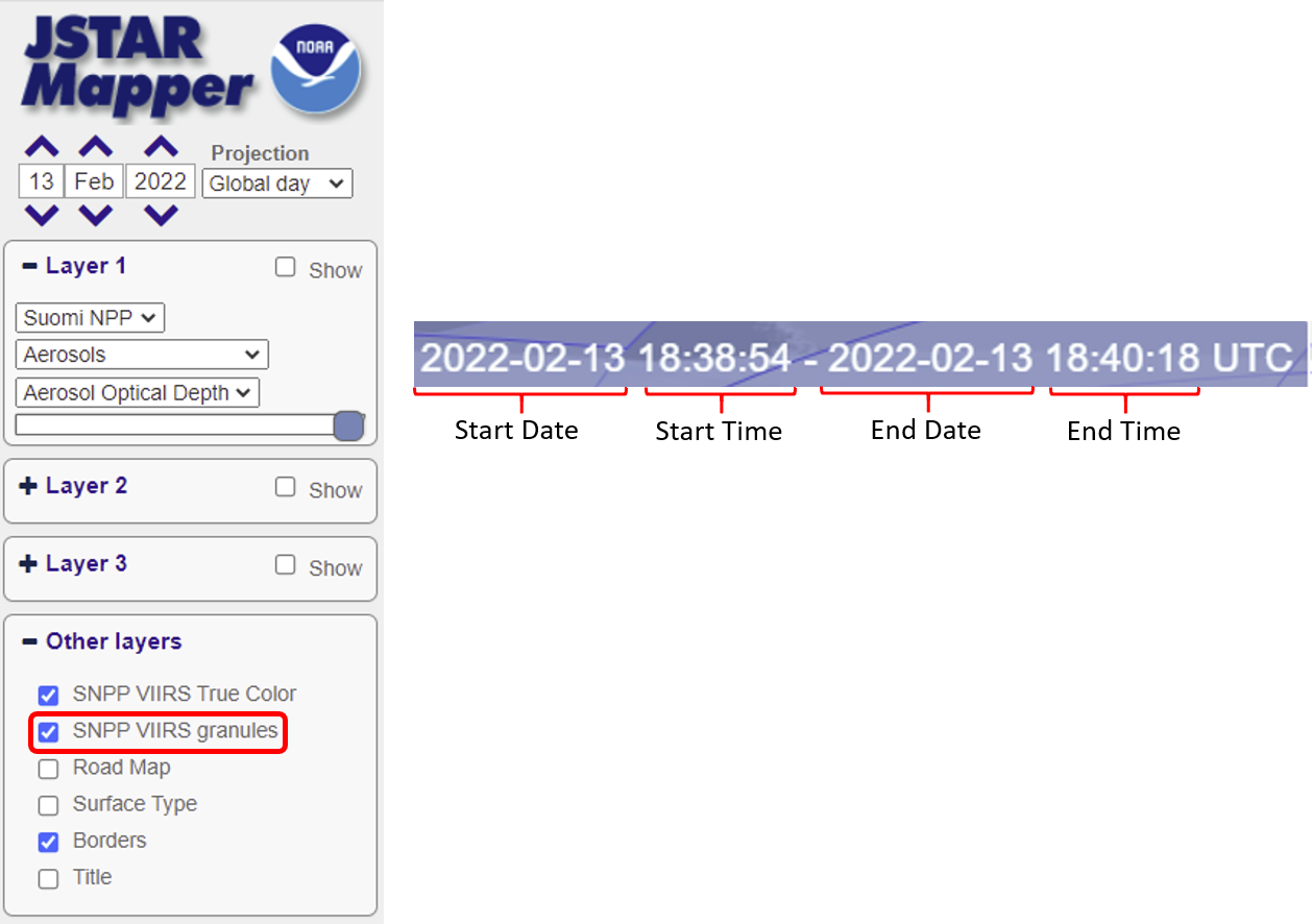
There are two ways to find the approximate start and end times for the granules over a given region. The easiest approach is to use the VIIRS granule layer on NOAA’s JSTAR Mapper. The figure below is a screenshot of the interactive menu on the left side of the webpage. Under “Layer 1”, select the satellite for the VIIRS observations of interest (“Suomi NPP” or “NOAA-20”). Then under “Other layers”, click the small box next to “(satellite name) VIIRS granules”. An overlay will appear over the VIIRS true color image, showing the VIIRS swaths and individual granules outlined in light blue. Hover your cursor over any of the granules; a blue shaded text box will appear in the upper right-side of the page. An example of the text box is reproduced below (click image to open full size version). The box contains the start/end date and start/end times of the granule. Note the start times for all the granules that cover your region of interest, and use the time range(s) when searching for data files via the JPSS NODD on AWS or in CLASS.
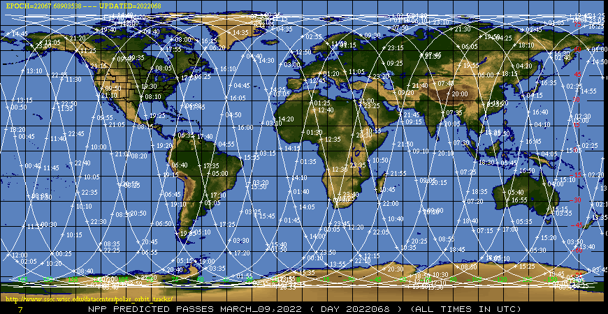
If the VIIRS granules layer is not available on JSTAR Mapper, you can find the approximate observation times of VIIRS from the SSEC Polar Orbit Tracks website. Under “Orbit Track Links”, click on the satellite for the VIIRS observations of interest (“NPP” or “NOAA20”). Then scroll back to the top of the page and click the button under the map image that says, “View Image in New Tab”. You will see a global map with narrow white lines indicating the center of the VIIRS swaths, with increments marking the approximate location of VIIRS every 5 minutes, as shown in the example below (click image to open in a separate tab). There are two sets of lines, one for the daytime (ascending or south-to-north) orbit and one for the nighttime (descending or north-to-south) orbit. Be sure to pick the correct orbit: VIIRS aerosol optical depth (AOD) and aerosol detection product (ADP) data are available during the daytime only, while VIIRS active fires (AF) data are available for both the daytime and nighttime. The SSEC website does not show the individual granules, but you can get the approximate range of VIIRS observation times for your region of interest, which will help narrow your search for data files via the JPSS NODD on AWS or in CLASS.