
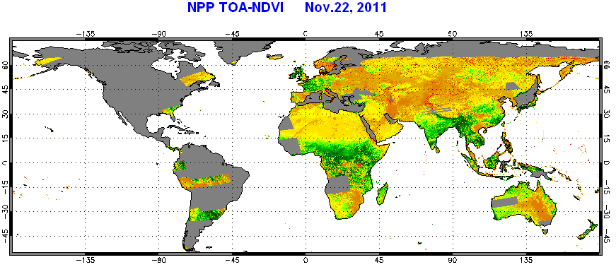
STAR - Global Vegetation Health Products: VIIRS First TOA NDVI image
VIIRS Vegetation Index (VI) EDRs are produced by the Joint Polar Satellite System (JPSS). Below are images of daily Normalized Difference Vegetation Index (NDVI) at Top of Atmosphere on Nov. 22 ,2011 created from VIIRS VI-EDR dataset.
Gloabl TOA-NDVI
Gloabl TOA-NDVI, composed by more than 1000 granules. Because this was the second day that NPP VIIRS started to distribute data, the system was still under tuning stage. Some granules were not availble.
High resolution TOA-NDVI
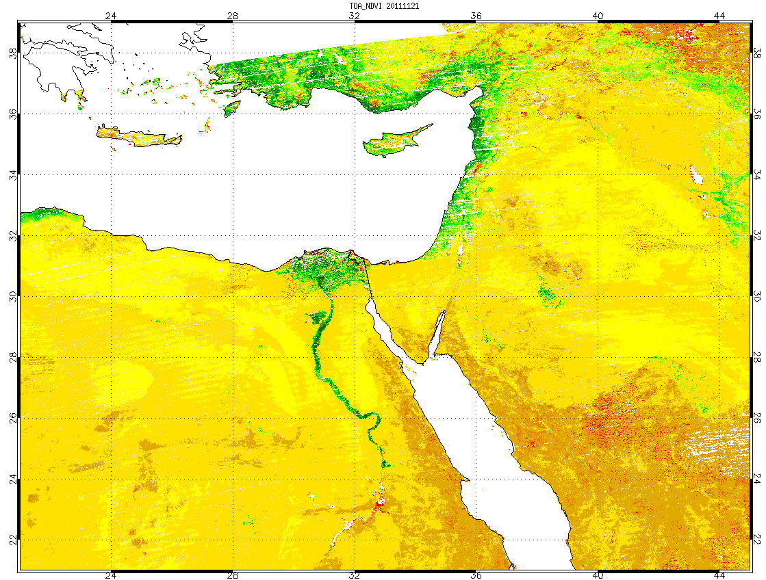
TOA-NDVI was produced by using VIIRS images bands with resolution of 375 meters at nadir. Thus, TOA-NDVI map with resolution of 0.005 degree (about 5km) can be created. There were only small number of missing pixels. Some white pixels (missing) shown in Delta area are due to cloud contamination.
TOA-NDVI near Red Sea
(resolution: 0.005 degree)

TOA-NDVI near Red Sea
(resolution: 0.02 degree, gap filled)

TOA-NDVI near Red Sea
(resolution: 0.02 degree, without gap filling)
Please click the image to see a big picture.