
Paraguay Flooding - June 2014
Links
- STAR Report for Paraguay Flooding
- Imagery Team Blog Post on the flooding
- Surface Type Map
- False Color Image
- Flood Map
- VIIRS 90m Water Mask TFW
- VIIRS 90m Water Mask TIFF
- VIIRS I-1 band Before and After
- Overview Powerpoint, (PPTX, 15.99 MB)
- VIIRS I-1 Band Imagery, Flood Map, and False color, (PPTX, 8.06 MB)
- Natural Color Before
- Natural Color After
- Flood Map TIFF, (TIF, 59.54 MB)
- Google Earth VIIRS I1 Band Overlay, (KMZ, 1.62 MB)
June 27, 2014 - Recently the Paraguay River, particularly through the Paraguayan capital of Asuncion, has experienced large scale flooding, causing the displacement of thousands of people. The VIIRS instrument on S-NPP has been used to capture the extent of the flooding. Here is the STAR Report for Paraguay Flooding. Below are some images of the affected areas created from VIIRS data.
Drag bars in the images below to see before and after.


Natural color images created from VIIRS I-bands-1, -2, and -3, from June 2 (left) and June 30 (right). The Paraguay River runs southward through the center of the image. Source: Curtis Seaman, CIRA


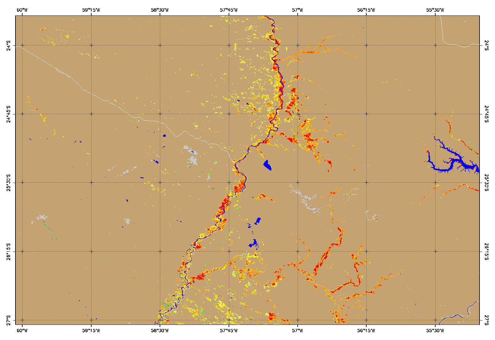
Flood detection map (left, warmer colors indicate more flooding) derived from VIIRS data and false color imagery using VIIRS bands I-1, -2, and -3 (right) from June 30. Source: Sanmei Li, GMU (funding provided by JPSS Risk Reduction program)


VIIRS Surface Albedo over Paraguay from June 1-10 (left) and July 1-10 (right).
Flood Mapping at Asuncion, Paraguay

Surface Type map shows flooding in Paraguay. Source: Jerry Zhan, STAR